The software allows users to publish the altitude profile of a tracklog recorded with a GPS receiver. #Altitude chart #Record tracklog #Elevation plot #Elevation #Altitude #Chart
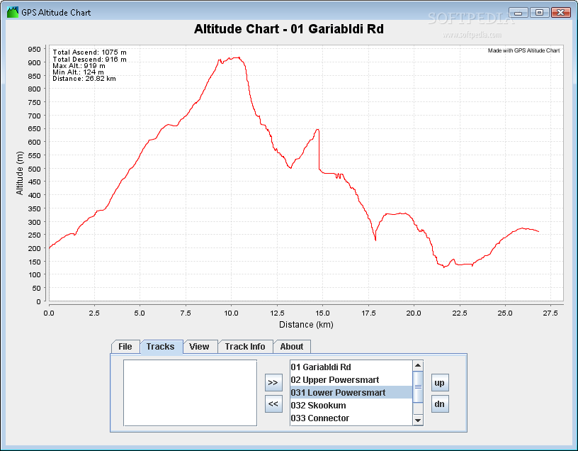
Did you ever want to print or publish the altitude profile of a tracklog recorded with a GPS receiver? As long as you are using Garmin software you probably were not too happy - at least I wasn't! Now there is a better way to generate an elevation plot:
GPS Altitude Chart application offers a viable solution when it comes to problems related to printing or publishing elevation plots.Just export your recorded GPS tracklog in the "GPS Exchange" format with any software suitable for your device (such as Garmin MapSource, g7ToWin, Fugawi, GPS Trackmaker or other
GPS Altitude Chart displays the elevation plots over distance, time or both on the screen. The displayed elevation profiles can be saved either as a PDF file or a PNG image for further use in any kind of document or web publishing.
System requirements
What's new in GPS Altitude Chart 1.2.2:
- set position of annotations
- force German chart labels
GPS Altitude Chart 1.2.2
add to watchlist add to download basket send us an update REPORT- runs on:
- Windows All
- file size:
- 2.7 MB
- filename:
- GPSAltitudeChart.zip
- main category:
- Others
- developer:
ShareX

Context Menu Manager

Zoom Client

Bitdefender Antivirus Free

calibre

4k Video Downloader

IrfanView

7-Zip

Microsoft Teams

Windows Sandbox Launcher

- 7-Zip
- Microsoft Teams
- Windows Sandbox Launcher
- ShareX
- Context Menu Manager
- Zoom Client
- Bitdefender Antivirus Free
- calibre
- 4k Video Downloader
- IrfanView