Map any area with custom tracks and individual paths for outdoor use or any other purpose you might find while assuming the role of a modern cartographer. #Calibrate map #Map waypoint #Map creator #Map #Raster #Calibrate
Although at this point maps are a thing of the past, we're still relying on them in updated form whether it is online via some service, on our phone through some application, or in the city center on a digital rendition of one. OkMap seems to bring back some of that former glory by allowing users to create their own maps depending on their needs and outdoor activities.
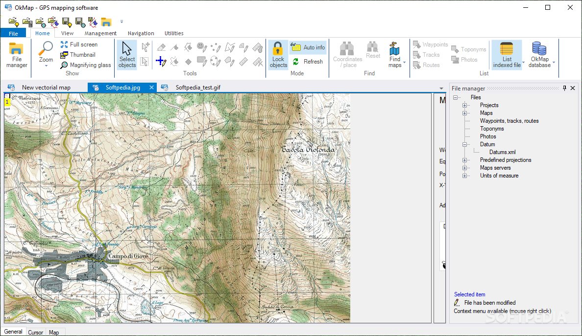
Although you might feel familiar with the program itself, you'll notice that it does have a certain authentic side. Yes, it looks a bit like Microsoft's Office application menus, but to a very small extent, giving this program a familiar aspect without losing its original look. You can easily find the function or functions you are looking for, making it a breeze to actually work with this program.
As you launch the program, the first thing you'll notice is that you can either launch a new project, work with a recent one, or simply clear any of the previously developed ones. You can integrate web maps or simply load a classic written version in digital form, scanned or otherwise.
Waypoints can be added in order to create some sort of track. For example, if you love to go biking outdoors, and would like to create a custom way to go, this app can help you integrate your ideas on an already existing map.
OkMap is a program that outdoor people and individuals with an interest in mapping areas will find useful. With lots of integrated tools, there is no doubt about how helpful it can be to create your own custom paths and even share them with other eager users. In the end, you could consider yourself a modern cartographer.
Download Hubs
OkMap is part of these download collections: Convert SHP, Open SHP, View DCW, View SHP
What's new in OkMap 18.4.0:
- EPSG update to version 11.007.
- New feature: Receiving tracks and waypoints from a public web server.
- New feature: Sending your location to a public web server.
- Map: New context menu: Sending waypoints to a public web server.
OkMap 18.4.0
add to watchlist add to download basket send us an update REPORT- runs on:
-
Windows 11
Windows 10 64 bit
Windows 8 64 bit
Windows 7 64 bit - file size:
- 43 MB
- filename:
- okmap.zip
- main category:
- Science / CAD
- developer:
- visit homepage
ShareX

paint.net

Bitdefender Antivirus Free

Microsoft Teams

7-Zip

IrfanView

Zoom Client

Windows Sandbox Launcher

4k Video Downloader

calibre

- Windows Sandbox Launcher
- 4k Video Downloader
- calibre
- ShareX
- paint.net
- Bitdefender Antivirus Free
- Microsoft Teams
- 7-Zip
- IrfanView
- Zoom Client