A compact application that helps users create topographical or cadastral plans, while offering support for AutoCAD or other CAD platforms. #Topographical plan #Cadastral plan #Terrain model #Topography #Cadaster #Terrain
TopoLT is a software application designed to help users create topographical or cadastral plans in digital format on AutoCAD or other CAD platforms.
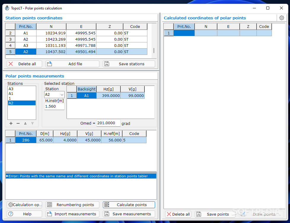
The program features three different panes, with each one built specifically for offering you assistance in drawing coordinates from total station or send coordinates to total station directly, receiving measurements from an instrument, as well as viewing the 3D models that were obtained through calculation.
The three windows sport a clean and straightforward layout that allows users to perform most operations with minimum effort.
TopoL gives users the possibility to draw points directly from the specified coordinates, and save the coordinates to a file for using them in another projects. Plus, you can import data from various file formats, such as COO, CSV, XYZ, REC, SDR, GSI, GDM, RAW, and others.
What’s more, you can add multiple stations to the list, calculate the point coordinates by two methods: polar and direct intersections, and perform searches for finding points.
Another important option worth mentioning allows you to receive measured data on serial port (COM1, COM2) from various instruments (e.g. total station, field book). In order to receive data on serial port you need to connect the instrument to the PC and set the parameters for serial communication. Plus, the information can be saved to a plain text file.
Last but not least, you can view the models in a 3D working environment, rotate them to different angles, save the generated information to an image file (JPG, BMP), change the background colour, size, light intensity, and texture quality, select the 3D drawing mode for the selected objects (3D faces and lines), record the 3D rendering mode to an AVI file, upload 3DS files, and switch to a full screen mode.
TopoLT comes packed with many useful features for helping users develop 3d terrain models or other projects in a professional way.
TopoLT 16.0.0.2
add to watchlist add to download basket send us an update REPORT- runs on:
-
Windows 11
Windows 10 64 bit - file size:
- 69 MB
- filename:
- topolt.setup.(64bit).zip
- main category:
- Science / CAD
- developer:
- visit homepage
ShareX

calibre

Bitdefender Antivirus Free

Windows Sandbox Launcher

IrfanView

7-Zip

Context Menu Manager

Zoom Client

4k Video Downloader

Microsoft Teams

- Zoom Client
- 4k Video Downloader
- Microsoft Teams
- ShareX
- calibre
- Bitdefender Antivirus Free
- Windows Sandbox Launcher
- IrfanView
- 7-Zip
- Context Menu Manager