14 DAY TRIAL //
 So far, I think that Google deserves its success. Not everything is perfect about Google but it definitely makes our live easier and still manages to make a lot of money. Google is growing exponentially and in this process it acquires different companies, offers a lot of free services and a lot of paid ones and bothers a company that the Linux world doesn't like. In 2004 Google acquired Keyhole and transformed it in Google Earth. From that day on , Google started to improve that software by integrating it with many of its services, especially Google Maps.
Now Google Earth is available for Linux too. We also have a free version that benefits from most of the software's functionality. What more can we wish for? It's an excellent one of a kind application that runs well on Linux; it's free (as in free beer) and makes money for Google so we don't have to pay for it. I don't really think people would pay for it, but I think this solution is a much better one.
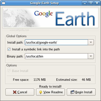
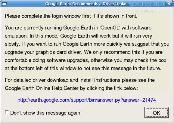
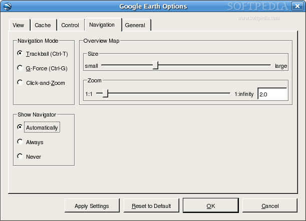
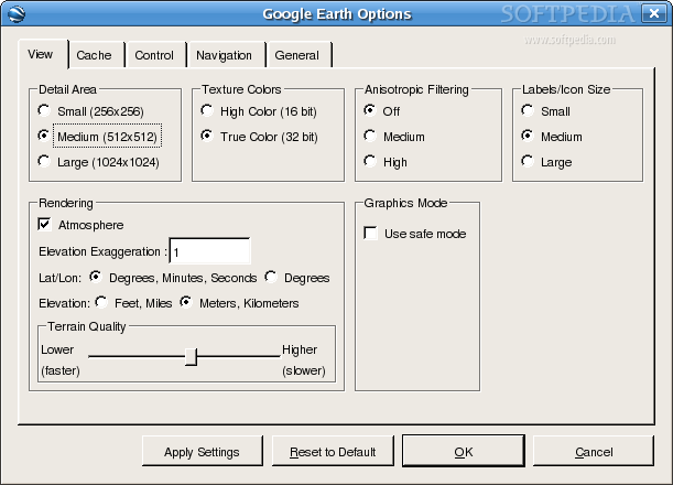
Google earth tries to be a software for anyone. Installing it is very easy as it comes in a binary file that takes care of all the installing process. If you haven't installed the graphics card you'll not have 3D support. Google Earth warns you about this and tells you that it might be an issue. I thought it was a great thing that it started without 3D support because I wasn't in the mood to install the card. After starting the software for the first time it took about 20 minutes until I used it. You can't imagine how slow are rendered some elements without 3D and how fast it is otherwise.
This version of Google Earth is the 4th and it's the first one supported on Linux. Minimum system requirements are kernel 2.4, glibc 2.3.2, x.org R6.7 when it comes to software and for hardware you need at least a 500MHz CPU, 128MB RAM and 400MB free disk space. In this matter, I'll recommend using a fast Internet connection, because the high resolution pictures will hopefully use all the bandwidth you can provide.
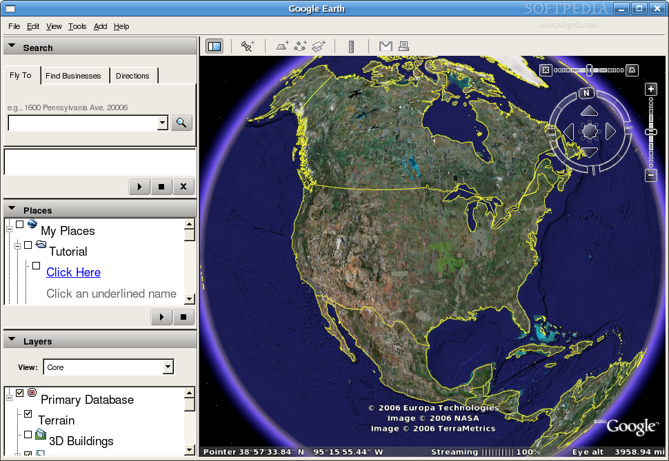
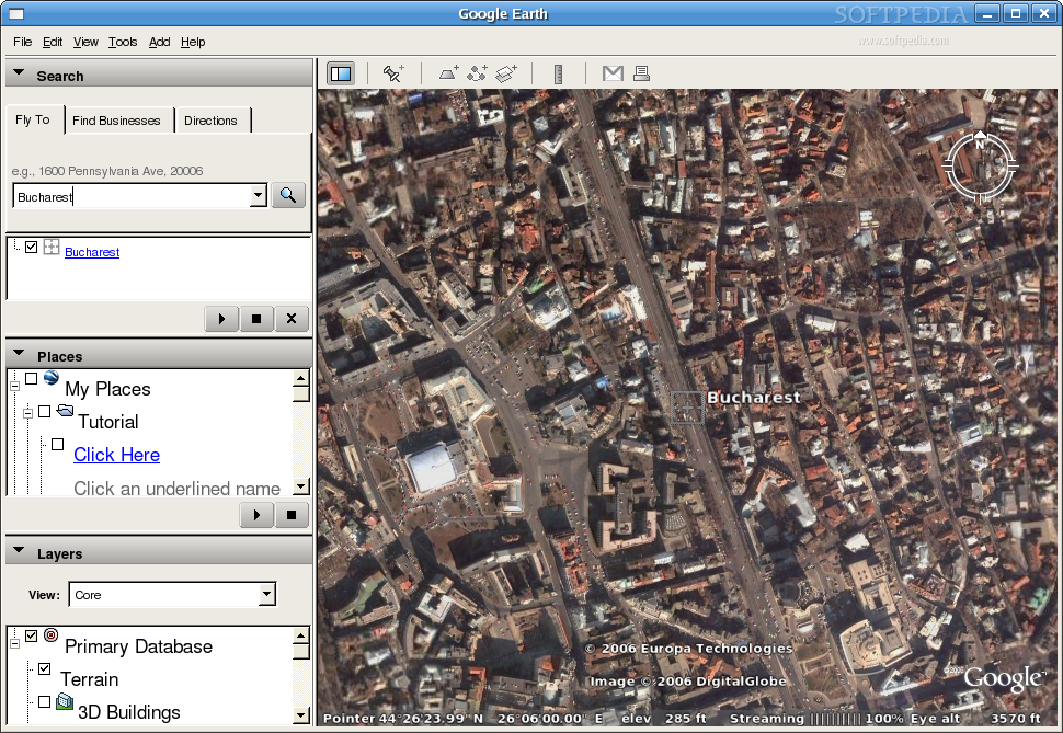
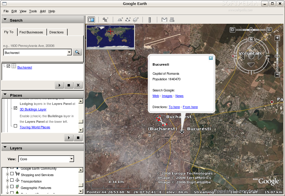
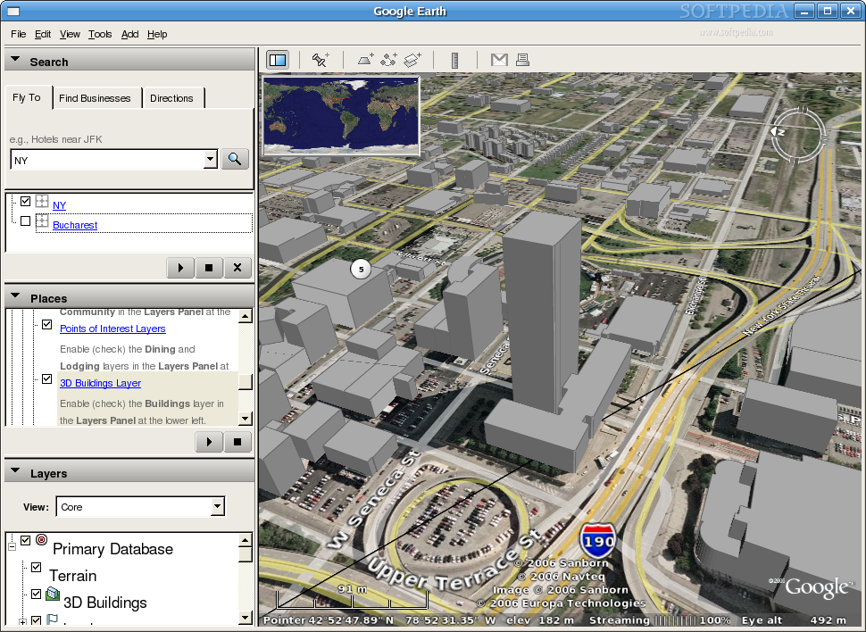
What is Google Earth good for? First of all Google Earth is a very fun software. It provides a bird's eye view for many locations on the planet. You can visit almost any place in the world and see some spectacular things that perhaps you've never even dreamed of visiting. If you are lucky you might even be able too see your own home. As you can imagine not all the places in the world where scanned by the satellite and even less where mapped by Google Maps but this software is still useful.
Residents of USA will benefit the most since it has the most complete line of services. You can visit places like The Grand Canyon or Mount Saint Helens and you'll see a lot more than a 2D texture on a spherical globe. In those places, and I'm certain there are others too, you can view the 3D terrain.
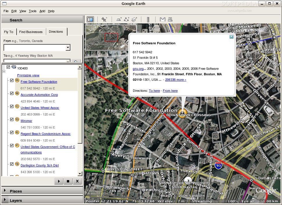
Google Earth uses layers to display a variety of data of general interest. Some of the things included in this layers section are borders, roads, populated places, transportation, 3D buildings and a lot of other points of interests. It even has a layer with stuff added by the Google Earth community.
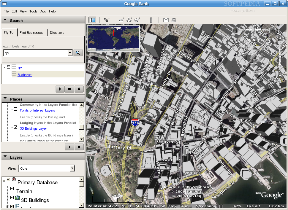
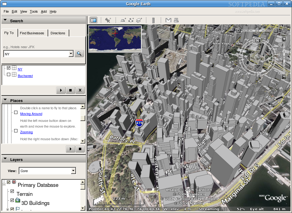
As you read before, Google Earth has a layer with 3D buildings. This is a very interesting feature and since satellite pictures are 2D, this feature opens this software to a lot more possibilities. In version 4 this software has a new great feature. It has the possibility to have textured buildings and this allows Google to create a realistic model of the Earth. Since this version is not even final yet, you will not be able to locate many textured buildings. If you want to see something really nice just go in Manhattan and if you activate the 3D buildings layer you'll see a bunch of non-textured buildings. Imagine how cool would this be if they where all photo-realistically textured. I don't want to spoil your happy thoughts but imagine the amount of bandwidth that will be required for viewing Manhattan this way. I have a good news that comes packed with a bad one. For creating 3D models of buildings, Google provides a freeware software called Google Sketchup. This software is only available for Windows and OS X and hopefully it will also be available someday for Linux too.
The file format that Google Earth uses to add and share data (KML) has expanded capabilities since version 4. Since Google tries to integrate the creativity of millions of users who are adding and sharing geographic data it had to make KML better. Now when you import a KML you are not loading everything, but only the focused view, as it happens when you are flying around.
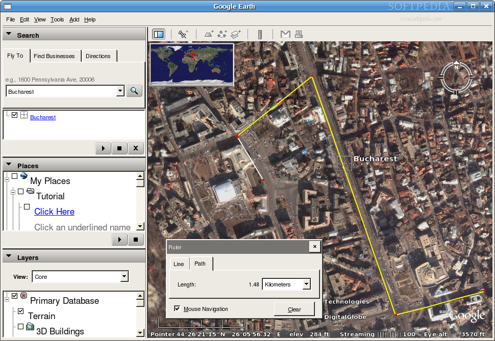
If you'd like to measure the distance from your house to work or from Paris to London this can easily be done. It is supported by both a line and a path and the unit of measurement can be easily changed. It seems pretty precise but I can't locate anywhere what's the precision of this tool.
Currently there isn't a Plus or Pro version for Linux, but since Google Earth 4 Linux is in beta stage we can expect that those will also be available. At least the plus version would be great to have since it should have support for GPS.
Since the Google Earth data can't be updated very often and since not even the whole planet was photographed you can imagine that some of it can be a little outdated. Google states that most of the imagery is approximately one to three years old.
The Good
Google Earth is an excellent unique software. It's free for personal use and perhaps it will not be another one like it for some time. It worked flawlessly in my case and it had all the features that you are expecting to see here.
The Bad
The only downside of this software is that some of the data is inaccurate and unfortunately Google puts accent on providing more data for USA than for the other places.
The Truth
The truth is that Google Earth might be part of our every day's live some day. This software really has a shining future. When the maps will be complete and the small devices will get more powerful, this software might find its real potential when used with a GPS device. Until that day, Google Earth is more fun than useful.
The screenshots below show Google Earth in action: