14 DAY TRIAL //
 One of these days, a friend of mine paid me a visit. He's a PHP programmer and, at some point, we started talking about his work. He needed to create a presentation for a website that he was working on but that was far from being thoroughly designed. For the presentation I suggested he can either create a HTML lookalike with a few working links or he can map a nice image of what the designer sketched. Since he had some sketches in bitmap format he decided to go with an image map editor. I remembered that Quanta was able to do something like this and after a little digging I realized that Quanta was very well integrated with a little software called KimageMapEditor. This is exactly what was needed here and what I'm about to review.
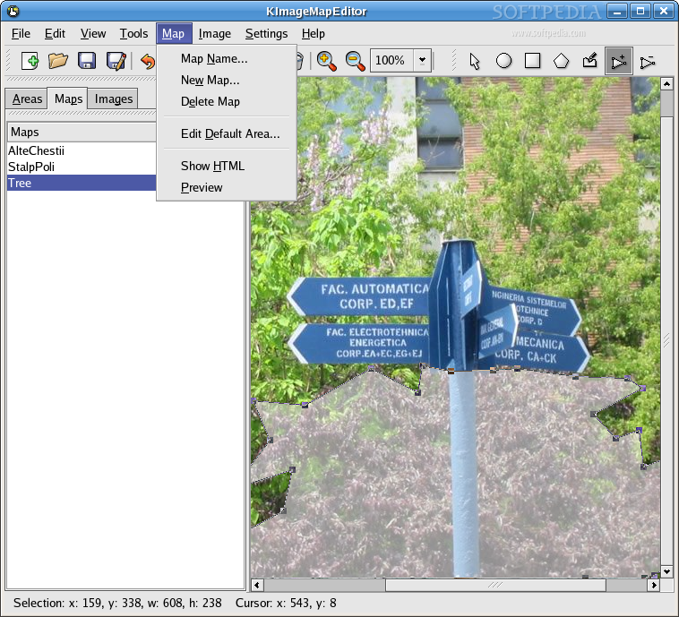
KimageMapEditor is a very easy to use tool that allows adding and editing image maps in HTML files. Since it is based on KPart technology it can be easily integrated with other KDE applications and, more importantly, it is well integrated with Quanta.
If you start with a blank file you'll see that in the workspace there is a big text that tells you to open either a picture or the HTML file you want to edit. If you intend to start from scratch with an image file you should know that the supported formats are JPEG, PNG and GIF. This is fair enough since these formats are generally used for online content; however, modern browsers support a lot more image formats than this software does, so the choice shouldn't be limited only to the aforementioned three file types.
When choosing to open an existing HTML file, the software will automatically detect the images contained in the code and the image maps assigned to that image, if there are any.
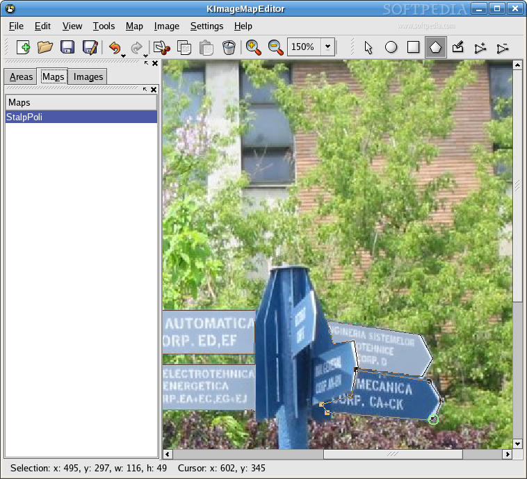
The Interface
The interface is very intuitive and getting used to it takes only a few minutes. At first you get the feeling that it is an over simplistic drawing program, because you can see a toolbar with different shapes that can be used to create maps on images. I guess it involves some drawing but not in the way an artist does it; it's actually more of a child's play.
In the main toolbar you have all the stuff that you get in most software that involves modifying things. I would like to mention that the undo / redo feature is pretty cool because it has a history function. If you hold the mouse clicked a little more on those buttons you get a drop-down list of all the actions available.
The second toolbar is the drawing toolbar and here you have different icons for creating circles, rectangles and polygons. The last two buttons give a lot of power to the software. They are used for adding and removing points to / from the polygons. If you have a very complex shape and don't manage to get it right from the first time, adding more points will make the map very precise. Removing points is useful mainly when you use the freehand polygon tool. It would be cool to have a tool that automatically selects an area based on the color similarity but unfortunately this might never be implemented in this software since development stopped in 2003.
In the right part of the screen you can see three tabs that show the created areas, maps and the used images. In the areas tab you can see the HREF field and a preview of the area. Several maps can be used and they all can be created or selected from the second tab. This is very useful when you have objects of different types because it helps keeping things organized. The images tab shows all the images that are in the HTML file that is to be modified.
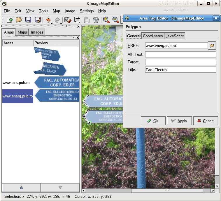
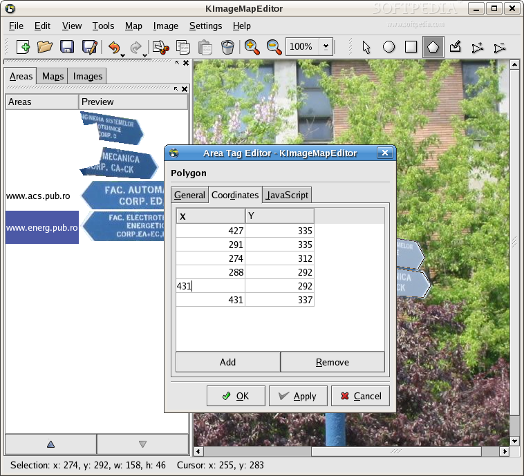
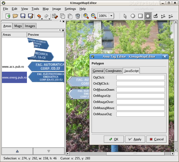
Double clicking an area opens the area tag editor where you can see the HREF, the "alt" text, the target and the title fields that correspond to that area. In the HREF field you can also browse your way to the file that is to be linked. In the second tab of the area tag editor you can see the coordinates of your area. They can be precisely modified from here, even though it is not much of a help because this task is much easier to do visually. The last tab shows several fields for adding JavaScript actions. This is pretty cool if you know JavaScript and it would have been a lot better if it had drop-down boxes for selecting parts of the code from there.
Configuration options for this software are pretty poor. You can only set the maximum image preview height and it's supposed to also support setting for the undo / redo limit but it doesn't work.
Anyway, I said in the beginning that my friend used it to create a presentation to a website that was only sketched. I've seen the results and I must say I was pretty impressed.
The Good
It is very easy to use and still powerful enough to provide precise mapping of areas. It integrates with Quanta and also provides very basic JavaScript tags that can be altered from this software or better from Quanta. Points from the polygons can be freely moved with the mouse and when needed they can be easily removed.
The Bad
Sometimes when you want to map an image from scratch the generated code is broken and modifications have to be made in order to get the job done. This is a big downside that eclipses all the other bad things.
The Truth
I actually played with it for several hours and I can safely say that it's a good program that helps a lot when you have to map images. The fact that it integrates nicely with Quanta is good for both programs. Unfortunately, the code generated by this software doesn't seem to work all the time, but with minor adjustments it can be fixed. Too bad that development stopped in 2003, because with little help this software can be great at what it does.
Check out this screenshots of KImageMapEditor: