14 DAY TRIAL //
 GNOME Maps is a rather new application in the GNOME stack that doesn't do a lot but is really promising. Here is a quick look at the latest stable edition.
If you’ve ever used GNOME, you already know most of the applications that are usually integrated in most distros with this desktop environment, or so you think so. The thing is that the GNOME stack is huge, and not all users are aware of this. There are many more applications and libraries that are not integrated by default in most distros and that use GNOME, in some form or another.
Like any other projects of its kind, some packages are better maintained than others. In fact, there are a few that haven't been updated in ages, and it doesn't look like they have a future with GNOME. The Empathy messenger seems to be one of these apps.
That doesn't mean that there is no room for new applications. Numerous other packages have been making their way into the stack. Many of them are still at the beginning and don't show much, besides potential. The GNOME Maps fits very well into this category.
Installation
I tested GNOME Maps in the daily build of Ubuntu 16.04 and Ubuntu GNOME 16.04. The regular Ubuntu distribution has the latest package, but it's not exactly the best place to try this. You will notice that not all of the elements are loading properly, and some of the features don't work.
On the whole, it is not a bad experience, but if you want to get an idea of how this application actually works, you will need a proper GNOME experience, and not Unity, which just uses some of the GNOME stacks.
You can install GNOME Maps in Ubuntu 16.04 LTS from the repositories, with Ubuntu Software Center, and it's present by default in Ubuntu GNOME.
Usage
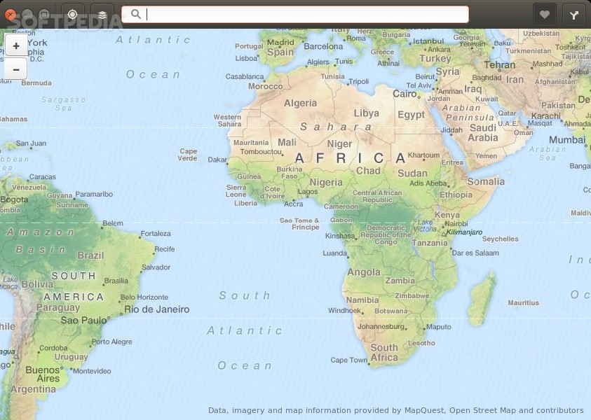
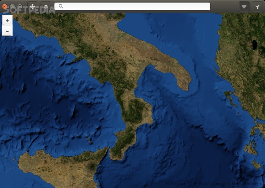
The interface and features of GNOME Maps are pretty straightforward, and you don't have to learn anything in order to use it. The application uses data from the OpenStreetMap Foundation, which means that you won't get insane levels of zooming for geographical maps. The roads and all the other details are much better.
Users can zoom quite a lot, but the role of the application seems to be focused in another direction. It just wants to give users quick access to a map and some basic tool.
Here is how the two versions differ, from Ubuntu to Ubuntu GNOME. You can find out your location on the map if you have the geolocation option enabled, but that's available only in GNOME, not Unity. Also, you can click on any place and query "What's here," but that only works in GNOME.
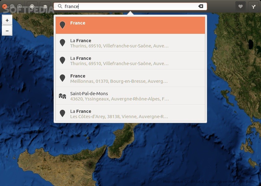
It's possible to copy the coordinates with the right click as well. Users can then use those coordinates in other applications. As you can imagine, you can also search for places, which seems to be pretty accurate.
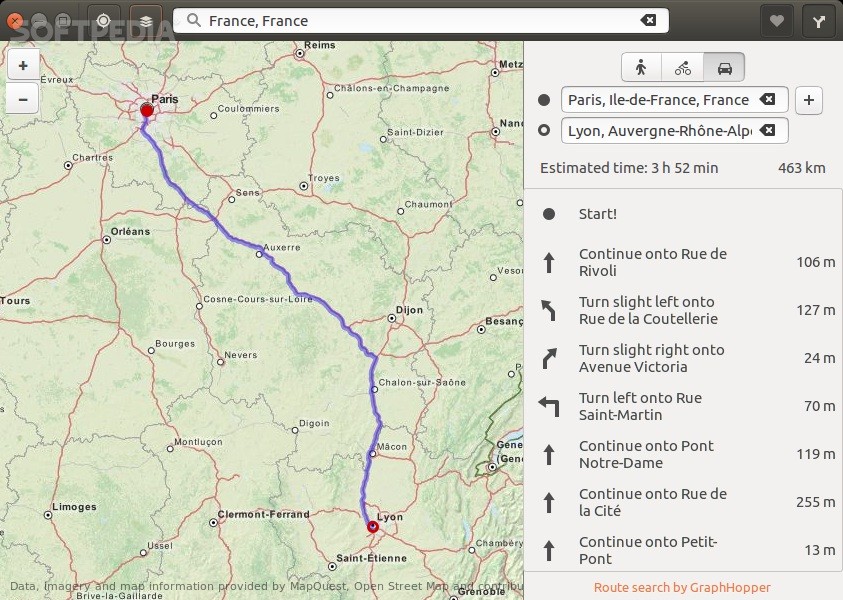
A routing service is available as well, for people, bicycles, and cars, but it's pretty simple, and it doesn't take into account many variables as traffic, tolls, and so on. It's there to give users a rough idea.
The last feature on the list is also pretty straightforward and allows users to bookmark places, but it doesn't seem to be working on Ubuntu 16.04 LTS, at least for now.