14 DAY TRIAL //
 Ever since the Stone Age people started to create maps. The main purpose of map-making was to be aware of your location taking into account, in ancient times, various geographical features. The first world map was made around 600BC in Babylonia called Imago Mundi. Starting with the great discoverers, the technology and accuracy of map drawings had seriously improved.
There were several persons that helped at revealing the shape, characteristics and the way the continents are displayed on Earth. The first person known to have discovered the overall round shape of the Earth was Pythagoras(6th century BC), Galileo Galilei an Italian scientist, contradicting the Bible, said that the Earth is moving, Christopher Columbus and Amerigo Vespucci who are the official by-mistake-discoverer and respectively the person after whom the American land was named.
The "Zeng He map" (1418) is supposed to be the first "accurate" world map that had the exact longitude displays and North-based orientation, features that were never used in other maps from that period. The modern maps from today are the result of revolutionary achievements which are part of different scientific categories. Carl Zeiss, a German optician who improved the lens manufacturing technology, the Wright brothers who flew the first successful aircraft(1903) and the first satellite to orbit the Earth (Sputnik 1, 1957).
Satellites nowadays are used for different purposes such as astronomical (observation of distant planets), communication, navigation (used for GPS - Global Positioning System), weather, reconnaissance (military and intelligence applications) and Earth observation. The last two ones provide the most advanced images of our planet. The first successful images used in mapping were the aerial photographs taken from airplanes but this technology is used with more accuracy by satellites.
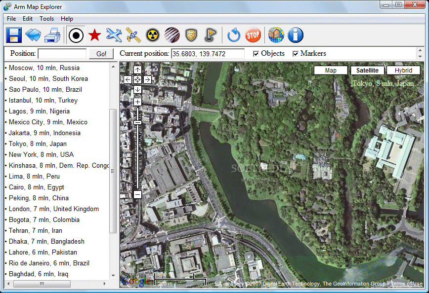
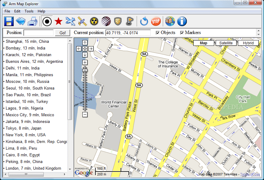
Arm Map Explorer is an application that provides high resolution images from Google Maps. This free program is able to provide you the view over the Earth's surface at up to 20 zoom levels. There are many features of this application that you might find useful. The Large Cities tab displays a list of some of the largest cities in the world (Shanghai, Moscow, Tokyo, New York, London, Toronto and many more) with the average population number (mln) and the country of origin. By clicking on one city you will be directed to its location on the map and you will be able to zoom in the map as far as being able to see cars or persons.
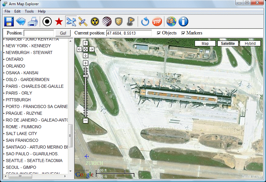
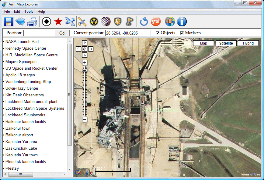
If you press the World Capitals button, a list of all the capitals in the world will appear and of course, if you click on it, the map will provide you with the aerial view on that city. The Largest airports tab opens a list of airports and you can be sure that because they are of great security importance the images are of an incredible zoom level (thanks to espionage). The same situation applies to the Space facilities tab, and in the list you can find places such as NASA Launch Pad, Kennedy Space Center, Baikonur Launch Facility, Kapustin Yar Area or Jiuquan Launch Facility.
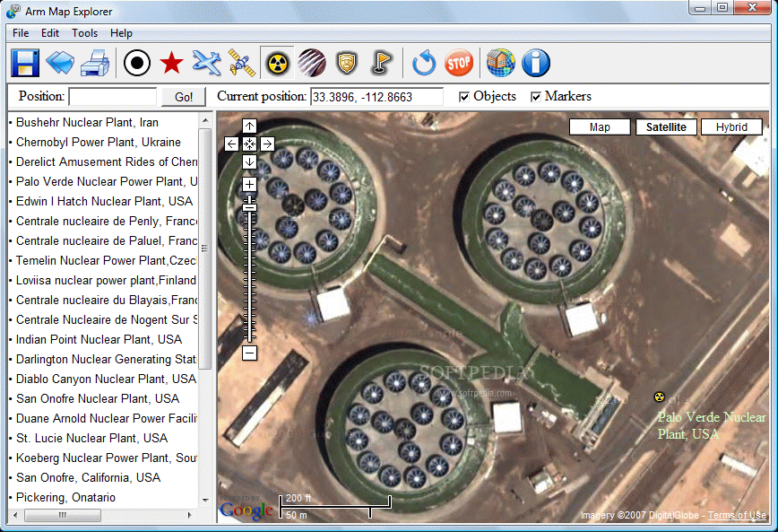
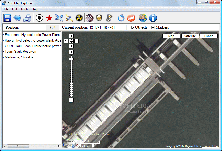
Have you ever seen a Nuclear Plant? If not now is the time. And I assure you that the No Trespassing sign will not stop you from having a close look at the most important nuclear plants. And to quickly find one you just have to click on a name in the list (Chernobyl-Ukraine, Paluel-France, Indian Point-USA, Atomic Bomb Crater Nevada-USA). I was surprised not to find in the list any nuclear plant related to Russia, China and even the argued about North Koreea. Are these locations that secret or just hard to find? If nuclear facilities were not enough for you, the application provides an extra 5 links to some of the largest Hydroelectric Power Plants (Fredenau-Austria, GURI-Raul Leoni-Venezuela or Madunice-Slovakia).
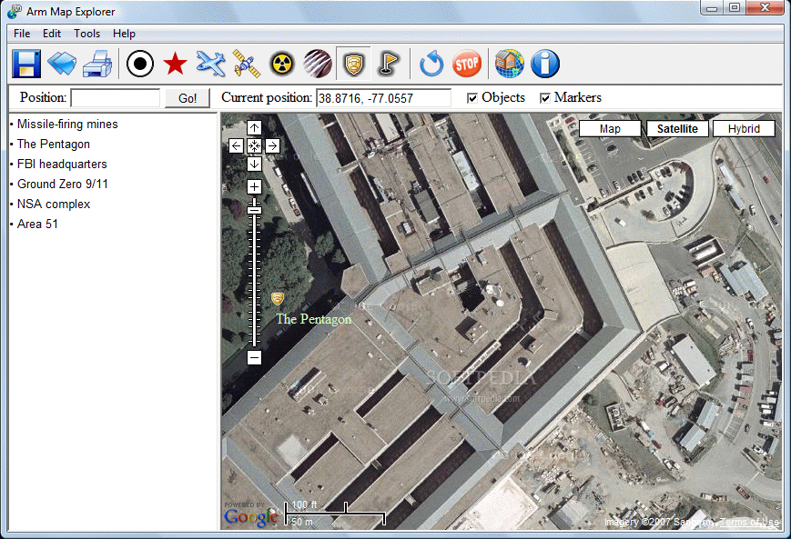
If all those "delicate" locations are being shown then why not have a peep over some American Military Objects (The Pentagon, FBI headquarters, the sad Ground Zero 9/11, NSA Complex). There is also the link to the Area 51 image and you really should take a look around that place just to check for any alien activity. Say "Hi" to Roswell for me.
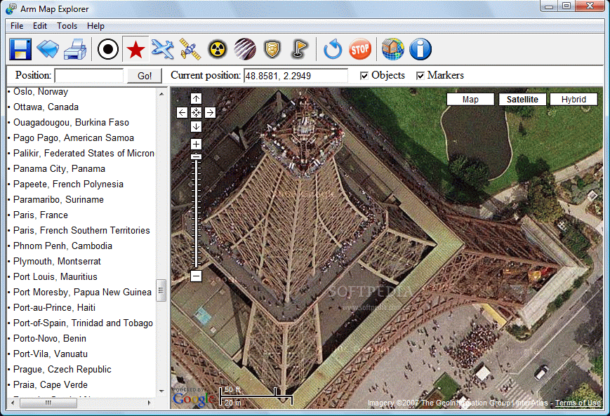
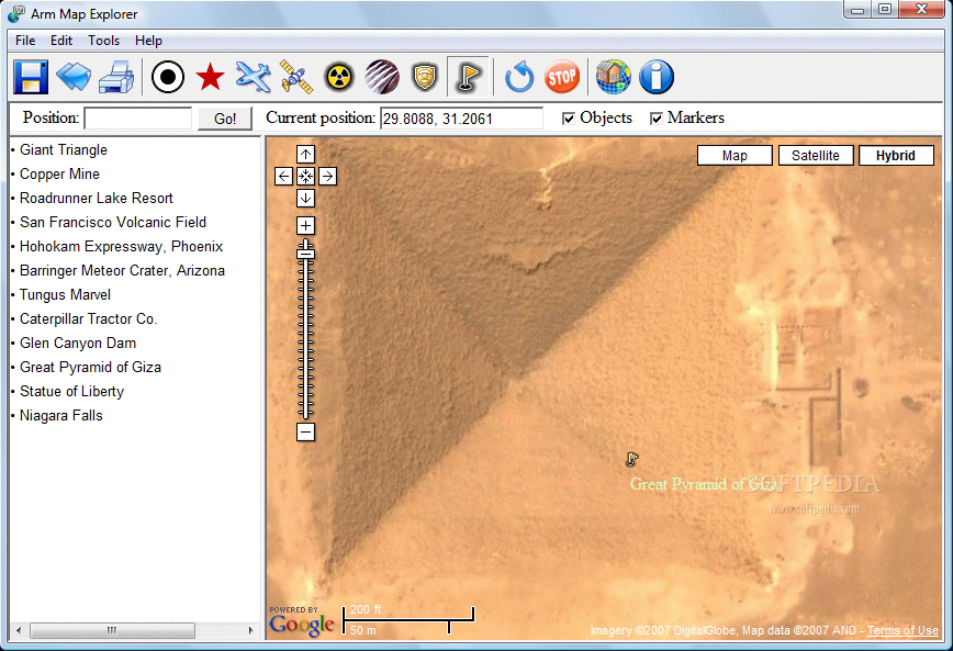
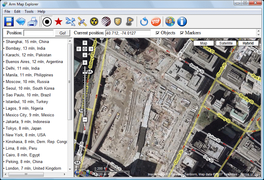
Just to relax your eyes you can click on the Other Objects tab. Here you can link to some interesting places on this planet (Giant Triangle, Copper Mine, Barringer Meteor Crater, Great Pyramid of Giza, Statue of Liberty or Niagara Falls). There are three ways of viewing all these beautiful places. The Map mode displays only the main roads and country boundaries without physical features, The Satellite mode shows only the satellite image of the area and the Hybrid tab mixes these two providing a complex view over a certain location.
Arm Map Explorer has a quite difficult feature, that of searching for a place by the coordinates that the user inserts. Unless you right down the data for a favorite location, as the program displays this data, it is very hard to search by coordinates if you have no advanced geographical background. The application also allows you to save or print the current image and to save the window position. Unless you used similar softwares, you must know that you cannot view all the Earth's surface at the maximum zoom level and this is just because some areas deserve more "attention" than others.
The Good
It is a very useful application but mostly for personal curiosity or because of the ability to take the printed images as actual maps, in case you are visiting that area. It is very easy to use and extremely handy.
The Bad
The search by coordinates feature seems a little bit uncomfortable for the common user and you cannot use the mouse scroll to zoom in or out. I don't know why, but the "delicate" locations are displayed mostly for USA.
The Truth
You should have a good Internet connection, because the application displays extremely high resolution images. You will able to see interesting places, given by the program or found by yourself, and most of all it is fun to spend your time with it.
Here are some snapshots of the application in action: