14 DAY TRIAL //
 Downloading maps for offline viewing can be done with the aid of specialized software applications. Google Maps Downloader is a smart and intuitive download manager that can help you accomplish this particular task without investing too much effort and time into the whole process.
Using straightforward actions and precise coordinate positions, this program is able to grab normal, satellite, terrain or hybrid maps and export them to small PNG files. The downloaded maps can be further combined into a larger map.
Leaving aside its downloading capabilities, the tool also integrates a built-in coordinate convertor and a map viewer so you do not need to fall back on third-party software utilities.
The dedicated downloading, viewing and conversion features don’t come for free. A license can be purchased for $49.95/€40.22. In the unregistered version, the program lets you adjust the maximum zoom level to 13, so you cannot save high precision images.
The map tiles grabbed from Google can be used for various purposes. You may create a map of your city or generate maps for world locations that you plan to visit. In addition, you can count on this program for building up maps for educational purposes.
Simple installation and straightforward GUI
Deploying the tool on your system can be carried out by simply pressing a few next buttons. At the end of a fast installation, you are faced with a clean layout.
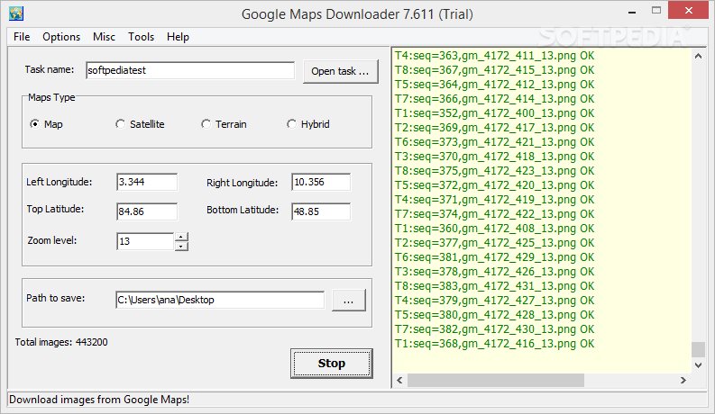
The GUI of the application actually coincides with the configuration panel and represents the workspace where you can input custom coordinates in order to grab image maps. The main window is made up of two small panels that give you the freedom to gain control over the configuration process and monitor the downloading task with the aid of a log.
Google Maps Downloader embeds a help manual in the feature pack in case you need to find out more about the function of each parameter. Consulting the help manual is not a mandatory step, as its options are pretty much intuitive and leave room for no interpretations and ambiguities.
Downloading capabilities
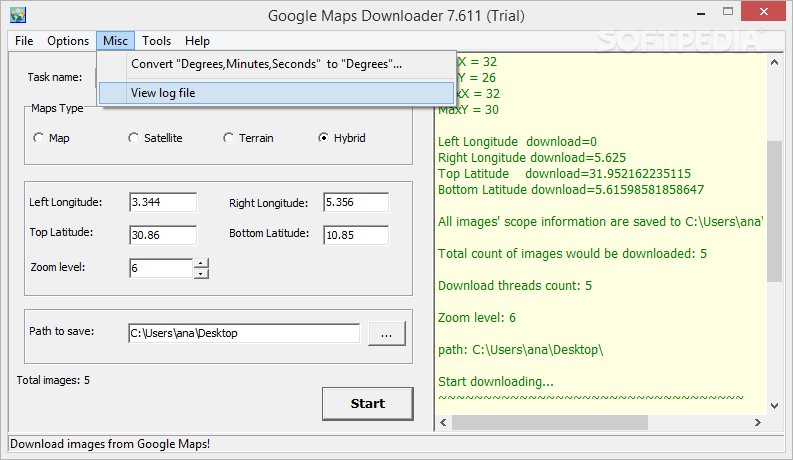
A new downloading task can be defined by providing information about its name and selecting the type of map that you are interested in, namely normal, satellite, terrain or hybrid map.
For capturing the exact location you need to input the coordinates, such as left and right longitude, and top and bottom latitude. In addition, you may enter the zoom level which defines what details on the map are shown or hidden (the maximum is 13 in the trial version). You don’t need to manually specify the coordinates if you already have them in other third-party tools, as you can use the copy/paste functions for adding information.
Furthermore, you can pick the target directory that stores all grabbed items. By default, the maps are exported to PNG file format.
Aside from the PNG images that are placed in the target location, Google Maps Downloader automatically creates for each task a file (EGMD file format) that includes the settings for the current project and plain text item with information about the coordinates (left and right longitude, and top and bottom latitude for each image).
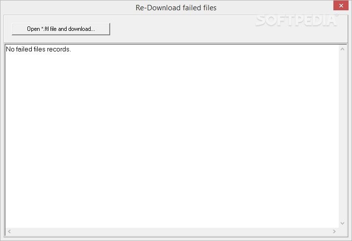
In addition, it generates a log which is exported to TXT and includes the same pieces of information which are revealed in the main window (e.g. project path, coordinates, minimum and maximum x and y values, total number of downloaded images, zoom level). Last but not least, it builds a file (FTL) file format which can be used for re-downloading failed photos.
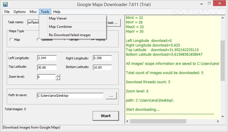
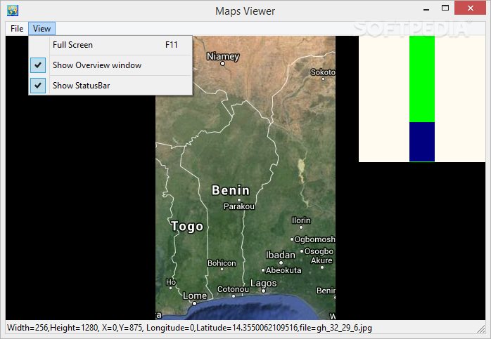
Map viewer and combiner
The Maps Viewer is designed specifically for helping you upload and view the images included in project file (EGMD file format). What’s more, you can explore the photo, check out the coordinates of your current position in real-time as soon as you hover the mouse cursor over a specific location on the map, as well as switch to a full screen mode.
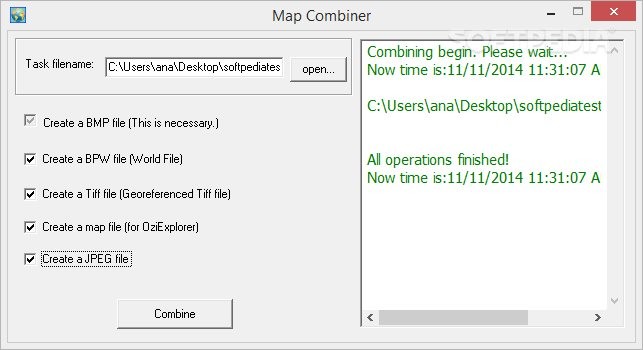
The Map Combiner gives you the possibility to merge all PNG files included in an EGMD project into a single BMP map. In addition, you can make the tool generate a BPW file (world file used by GIS – geographic information systems – in order to georeference raster map images), georeferenced TIFF item, map file for OziExplorer (advanced GPS mapping app for creating routes and waypoints), as well as JPEG picture.
Assessing its performance
Google Maps Downloader moves fast and grabs images without interruptions or errors. The time needed to download maps is bound to vary and depends on the user-defined coordinates. If you plan to download a bunch of maps, then the utility needs a longer interval to finish the process.
You can continue with your work, leave the app conduct the entire job in the background, and receive a popup notification when the process comes to an end. The application is not a resource hog. It’s friendly with CPU and memory resources so you don’t have to worry that the overall performance of your system is going to be burdened.
Conversion options and several configuration settings
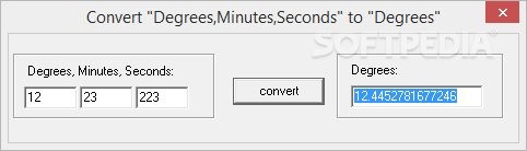
Google Maps Downloader allows you to convert degrees, minutes and seconds to degrees and copy the result to the clipboard so you may easily transfer it into other software utilities.
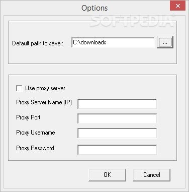
A few configuration settings help you specify the default saving folder and set up proxy parameters (IP address, port number, username and password).
The Good
The Bad
The built-in map viewer is simplistic and includes only basic navigation options. There’s no support for advanced editing features that could help you crop the image, flip it vertically or horizontally, rotate it to different angles, not to mention brightness and saturation adjustments, filters and image effects. You cannot embed text or image watermarks, insert user-defined text messages, and make use of a pencil, just to name of few editing parameters.