14 DAY TRIAL //
 Have you ever wondered how your country looks from outer space? Many people believe that the pictures we see on TV and presented as taken from satellite are phony and Earth definitely looks different. I for one generally guide myself on the principle ?I'll believe it when I see it? and ? to be frank ? I have never given too much thought to this idea.
And yet, as I haven't been confronted with proofs saying otherwise. On the contrary, I have all the reasons in the world to believe that what they feed us on TV regarding the above-mentioned matter is actually true. To support my arguments, I recommend you Satellite Image Download. It is a $25 application designed to download satellite views of a user defined geographic location and combine them into one, comprehensive image.
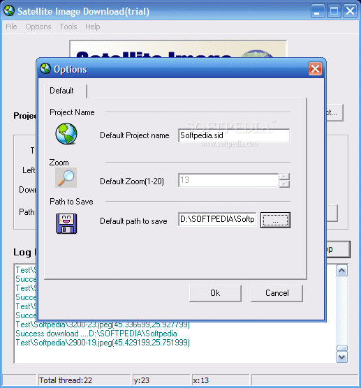
Sounds intriguing, I know, but the application actually does this. The interface is not much and there is nothing special about it. But functionality is the one feature the developer emphasizes and relies on. For full functionality and image quality the user will have to pay the price on the tag of the application as the only limitation imposed by the developer is the nastiest of all: high precision images cannot be downloaded in the shareware version (zoom is locked at 13 while the full version offers a zoom scale of up to 20x).
One piece of advice before we begin: do not attempt to use the application if you haven't the slightest knowledge on latitude and longitude. This is the basic condition for utilizing the application, as you will have to enter the Top and Bottom Latitude, Left/Right Longitude coordinates so that the focus is on the area of your interest.
For a better understanding of this matter, you have to know that the Top/Bottom and Left/Right coordinates are nothing else then the cardinal compass points guiding our geographic orientation. The values for South and West the values are always negative and for North and East are always positive. The numerical interval goes from -180 to +180 (East and West) and from -90 to +90 (North and South). By setting these values, you practically define a square on Earth to be captured from satellite.
As the application relies on Google mapping, sometimes the Google protection mechanism ?clicks open? by displaying an error message. This happens for service quality reasons and because of too many requests from the same IP address. In this case, Google blacklists your IP and sends the error message.
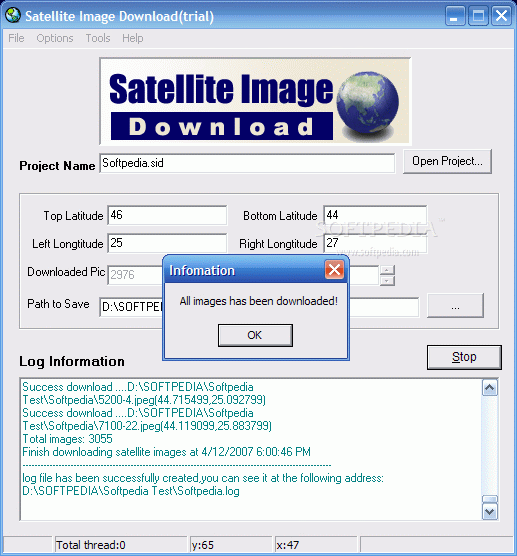
After filling in all the blanks (cardinal compass points and location for the file to be saved in) all there is to the matter is proceed to pressing the Download button. Depending on the ?Earth square? you have defined, the process takes more or less time to complete. You will be provided with a log of the operation stating the begin time (date included) of the download and the end time as well as the number of images downloaded.
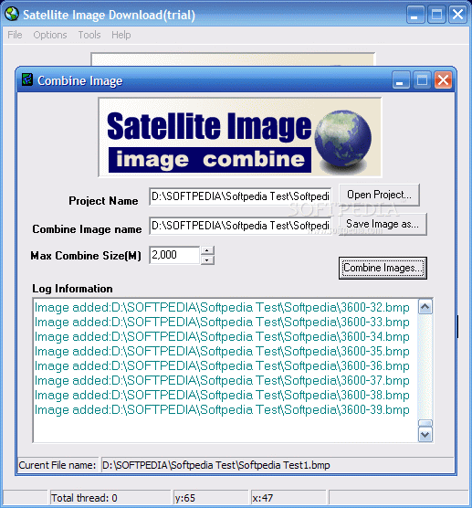
Don't worry if the number reaches hundreds or even thousands of files as they will be combined into one final picture in the final step. Now go to Tools menu and select ?Combine images option?. A new window pops up requesting you to open the project, define the saving location of the image and set the maximum combine size. The latter option goes as far as 2000MB, which is a shame, but not to worry, as the application will split it into as many files as necessary, all of them having values which are approximate to the maximum supported size.
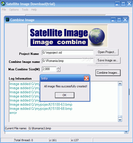
That is all you have to do in this dialog. All there is left is to press Combine Images button and you are good to go as the process will begin. Amazingly enough, I set the highest values for the cardinal compass points and the highest value possible for the maximum combine size and the software took its time to completing the job, without disturbing me with any error messages or alike.
Of course, I was the only one to suffer in this whole affair, as I had to wait about an hour for the process to complete, another half an hour for the images to combine and another half or so for the image viewer to open the file. The only issue was that the log recorded an error which impacted the end result (see the last picture at the bottom of the review).
The Good
The application proved to be stable enough and completed the process with no big fuss. The quality of the images is as good as can be as they are fetched from Google maps and that is the standard.
The log file will warn you about any errors that occurred during the ongoing process as well as the steps taken for completing the job.
The Bad
The price seems to me a bit high, but I am known as a notorious scrooge and have always objections regarding money-related issues.
The interface could use a Vista touch and the help file should be minutely revised as there are lots of spelling and grammar mistakes in there.
The Truth
Despite the mistakes in the help file one can't help notice the accuracy of the information and its value for a proper use of the software.
I suggest trying it for yourselves as the limitation does not hinder a proper testing of the application.
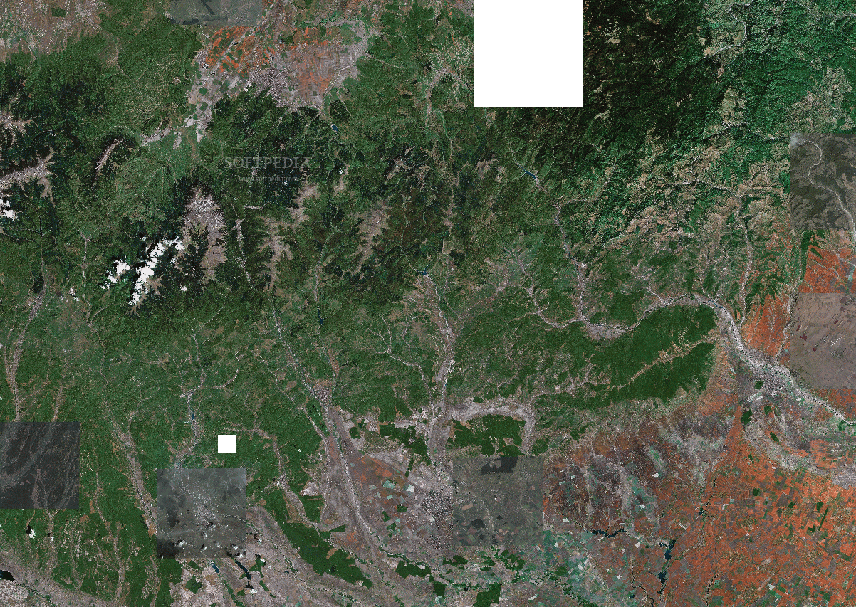
Here are some snapshots of the application in action: