Map areas using a GPS and echosounder devices, with the help of this complex hydrographic survey software tool wrapped up in an interactive interface. #Hydrographic survey #Area mapper #GPS map #Mapper #Hydrographics #GPS
Eye4Software Hydromagic is a complex hydrographic survey program that enables you map regions, display your GPS position on the map, record depths, and use an echosounder, among other actions. It sports a wide range of advanced features that are mainly geared toward experienced users.
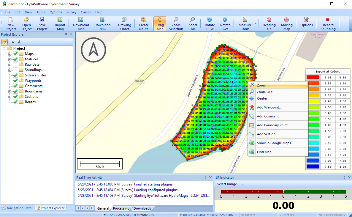
The GUI is pretty user-friendly, represented by a large window that shows the map, a project explorer to keep track of all map elements, a menu bar, and numerous buttons.
In order to start a new project, it is necessary to define the name and saving directory, map projection, project description, and surveyor. There are numerous projections available and they can be filtered by country as well as edited in properties (e.g. false northing, latitude of origin, parallel north, horizontal units).
It is possible to import maps, matrix and ASCII data, Hydromagic configuration files, along with previously done projects. Maps may also be downloaded, while a matrix can be generated from soundings and shorelines as well as shown as colors or depths.
Eye4Software Hydromagic is also capable of processing raw data and managing data files. You can create and administer waypoints, add soundings, shorelines and boundaries, generate corrected soundings from raw data, import photos, generate and manage sections, check out the sky view and echosounder display, show a L/R indicator, as well as enable moving map mode so it can show your current position in real time.
You can calculate geoidal separations for given points, convert measurement units, generate contours, view tide predictions for a given date, country, station, datum and timezone, customize the matrix color scheme, record sounding to file, draw boundaries by selecting corner coordinates, and so on.
The program had minimal impact on PC performance in our tests. It executed commands swiftly and remained stable throughout the entire evaluation. No error dialogs popped up, and the tool did not hang or crash. A complete help manual is available, which should be definitely consulted to learn how to use Eye4Software Hydromagic. In conclusion, this proves to be a reliable and skilful hydrographic survey application that should meet the requirements of most users.
What's new in Eye4Software Hydromagic 11.0.64.307:
- The software now supports multi transducer setups. You can now record and edit data from up to 8 dual frequency transducers;
- Water quality can be monitored by recording up to 12 parameters. At this moment sensors with ASCII or ModBus RTU interface are supported;
- A new graph editor allows you to edit GNSS elevation, motion, temperature and sensor data;
- New plugin to control Hydromagic features or autopilots with a Xbox game controller;
Eye4Software Hydromagic 11.0.64.307
add to watchlist add to download basket send us an update REPORT- runs on:
-
Windows 11
Windows 10 32/64 bit
Windows 8 32/64 bit
Windows 7 32/64 bit - file size:
- 89.6 MB
- filename:
- setup_hydromagic_demo_32bit.exe
- main category:
- Science / CAD
- developer:
- visit homepage
Bitdefender Antivirus Free

calibre

Microsoft Teams

Zoom Client

IrfanView

4k Video Downloader

Context Menu Manager

ShareX

Windows Sandbox Launcher

7-Zip

- ShareX
- Windows Sandbox Launcher
- 7-Zip
- Bitdefender Antivirus Free
- calibre
- Microsoft Teams
- Zoom Client
- IrfanView
- 4k Video Downloader
- Context Menu Manager