Install your satellite dish with the help of this tool that can compute all the angles, while taking under consideration all the factors. #Satellite Dish Calculator #Antenna Alignment #Calculate Angle #Satellite #Antenna #Alignment
In case you're the owner of a satellite dish or wish to acquire one, you must surely be aware of the importance of the placement dedicated to this instrument. Also, the installation itself may pose unexpected problems if you do not weigh all the variables.
To aid all users in such an endeavor, there is a software solution called Satellite Antenna Alignment that is ready to provide the necessary tools and functions. Through a simple yet neatly organized interface you should be able to find out all the results of the placement calculations in no time.
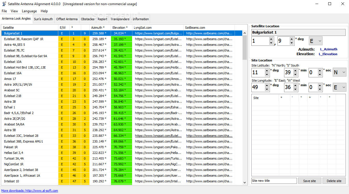
Starting with the antenna look angles, you can select the desired satellite and input the site location using the coordinate adjustment available inside the main window. The program can save and store several sites, so you can work with several potential positions.
The Sun's azimuth can be calculated from the next tab, so all you have to do is choose the date, time and time zone, then pick the satellite from the drop-down list.
Satellite Antenna Alignment can also be used for offset dish antennas and it will work out the angles for satellite elevation, offset and expected measured antenna. A great thing about this utility is that it can take into consideration various obstacles. This means that by providing the distance and height of the physical obstruction, you can find out its elevation angle and set the antenna to avoid interferences.
For anyone who needs to install a satellite dish and avoid any mishaps like having a building or a large tree in front of the receiver, Satellite Antenna Alignment is a quite useful solution that will surely prove its worth once it is put to the test.
Satellite Antenna Alignment 4.0
add to watchlist add to download basket send us an update REPORT- runs on:
- Windows All
- file size:
- 2.8 MB
- filename:
- saa_setup.exe
- main category:
- Science / CAD
- developer:
- visit homepage
calibre

IrfanView

Microsoft Teams

ShareX

Bitdefender Antivirus Free

Windows Sandbox Launcher

Zoom Client

7-Zip

Context Menu Manager

4k Video Downloader

- 7-Zip
- Context Menu Manager
- 4k Video Downloader
- calibre
- IrfanView
- Microsoft Teams
- ShareX
- Bitdefender Antivirus Free
- Windows Sandbox Launcher
- Zoom Client