14 DAY TRIAL //
 Geotagging applications are nothing new and there are many good ones out there to choose from. The vast majority of such programs will focus predominantly on letting you get the location into the photos and less on letting you use that for something impressive. While that is the norm, it does not apply universally and some geotagging applications such as Magrathea focus equally, if not more on presenting your geotagged photos in a pleasant way. After all, geotagging just for the sake of it is pretty moot? you need to actually see the images in a representative way to get the most out of it.
What it does Magrathea lets you add coordinates to your photos that point to the location where they were taken and it also imports this information if present from other sources such as a camera. Then it lets you organize your photos and present them in a Flyby slideshow that combines the location and photos in a cool way. With high quality satellite imaging of the locations of the images included in your slideshows, they take on a whole new dimension.
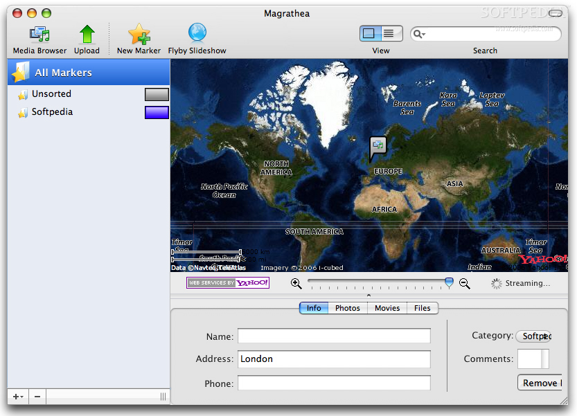
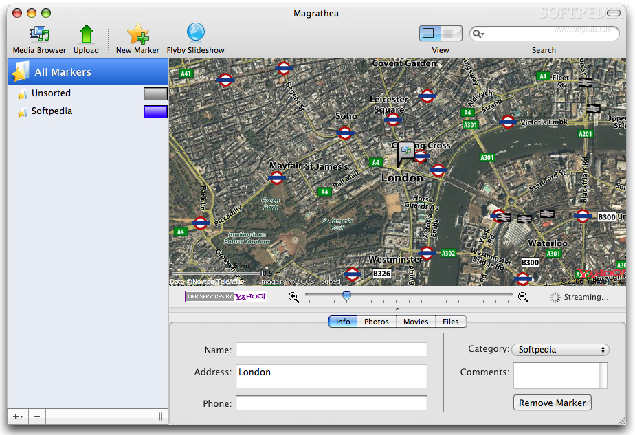
Working with it Magrathea has a rather novel approach to geotagging. It still uses the same old marker on the map to indicate the location the photos were taken in the case of images that don't already have this info, but you don't assign this information to the image as such. Instead, you apply a marker there and assign the photos to the marker. This makes a lot of sense since you rarely have just one photo taken per location and it is counter productive to keep assigning the same information to photo after photo. This way, the markers stay in place and if you ever take more photos at that location, they are very easy to add.
The markers themselves can be configured with names and categories which make it easy to manage a large number of them and they can also be assigned addresses and telephone numbers when appropriate. Each marker can house an unlimited amount of photos, movies and any other files.
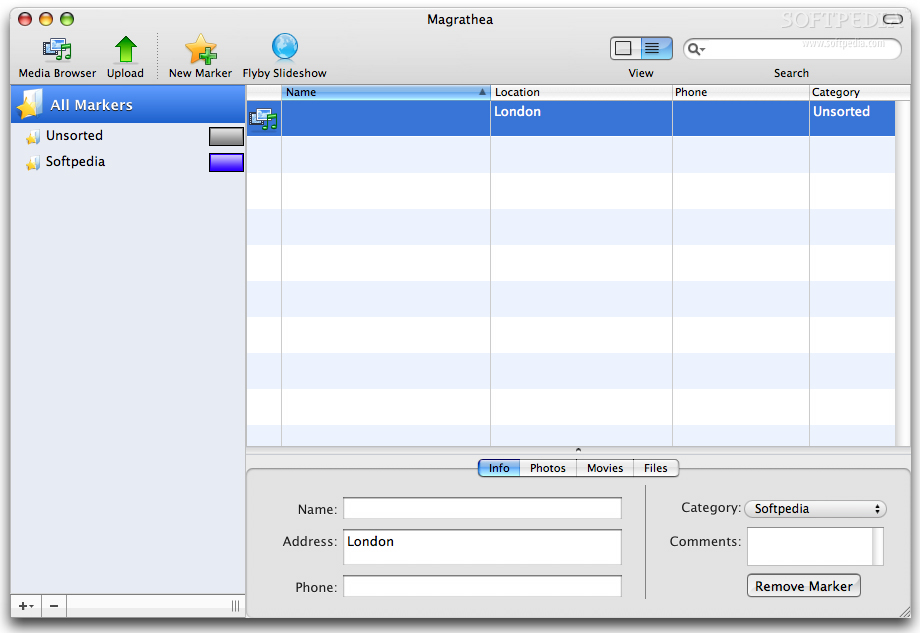
Once you are done, you can browse your photos using the map that goes down to the street level, or quickly skim them from the list view. If you are after something a bit more impressive, you can view a Flyby Slideshow that lets you select from a category of markers. Then it will take you to each location and play a slideshow of the images and movies associated with it.
Sharing Magrathea has also a strong Flickr integration and will let you view your friend's Flickr photos alongside your own on the map. Furthermore, it will also let you upload your photos to share with your family and friends. The program can guide through both setting up and authorizing a Flickr account for Magrathea to use. Once you are done, you can easily choose which photos to upload and who you want to let see them. After uploading you can also edit the information for each one as well as send links to friends and family via mail.
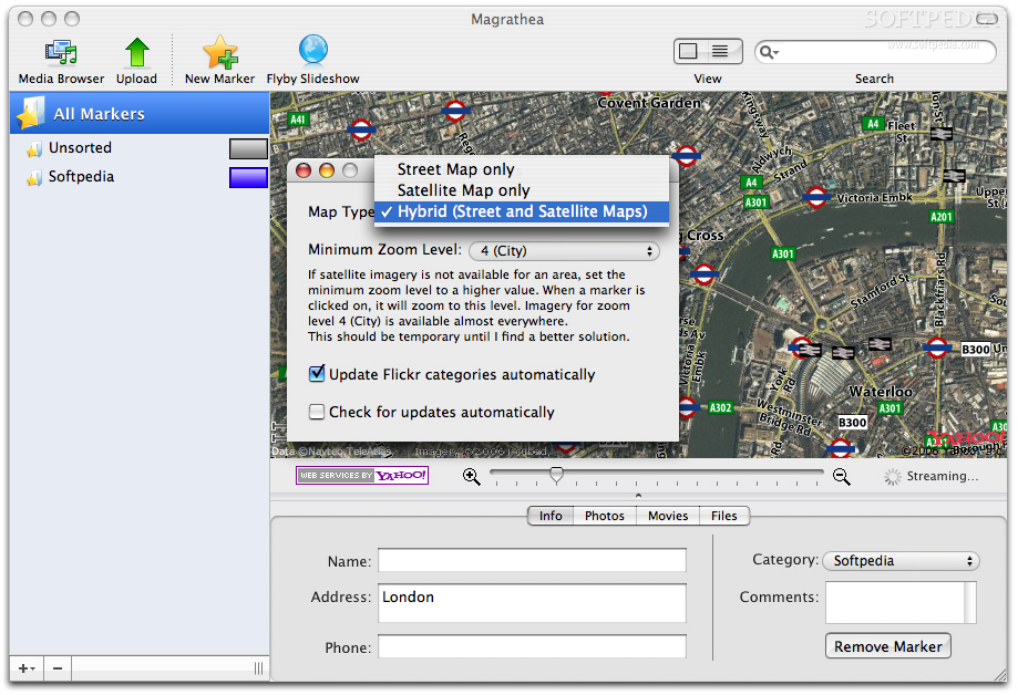
Map View Most such geotagging programs use Google Maps but Magrathea does things differently here and utilizes Yahoo's maps. I must admit that in general I use Goole maps, so I might be biased here, but I am under the impression that Magrathea's maps don't look that good. The satellite imagery seems to have a lower quality and the 'street' maps seem overcrowded.
To make things even worse, there is no easy way to alternate between the views. You can go with hybrid, which is a very weird mix, or you can opt for any of the other two, but you can only do so from within the preferences. While it's relatively fast, the extra step needed to perform this very simple operation is annoying. There's plenty of empty space on that toolbar, why aren't these choices there?
The Good The way the application works with markers is very nice and cuts down on a lot of redundancy. The Flyby Slideshow is a very visually appealing way to showcase your photos, which alone is a good reason to use this program. Last but not least, The Flickr integration is very nice for anyone that uses this service.
The Bad Apart from the choice of Yahoo Maps over Google Maps, this application has no shortcomings and even this is more of a matter of personal choice. The ability to easily switch between map modes from the menus is an annoying oversight though.
The Truth If you're in the market for a geotagging application, Magrathea is well worth a look. Even if you are already using another program, you can still take it for a ride since it will automatically load all the information from your images, so there is no need for additional work.
Here are some screenshots, click to enlarge: