14 DAY TRIAL //
 The “learn through play” technique is a very efficient way to memorize almost everything and I am sure everyone needs a little help when it comes to all those geographical facts that represent common knowledge. That is why GeoEdu is one of the nicest ways to improve your orientation skills. GeoEdu has actually two sections: the Atlas, offering general information, and the actual game, where you can see how much you have learned. The transition between the two is very fast, so you can always go back and forth, in order to clarify any question marks.
The Looks
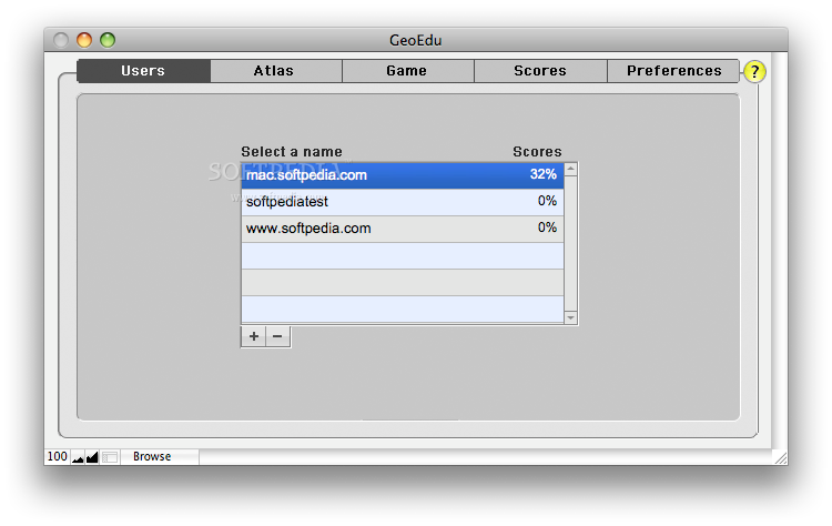
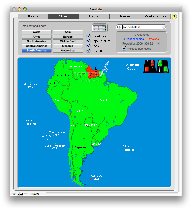
The GeoEdu interface is very well organized, based mainly on the tab concept. The first window provides access to the Users panel, where you can see the score for each player, the Atlas, the Game, the Score (offers detailed info for the current player) and the Preferences. The Atlas tab displays a map that can be modified to show a certain continent along with country delimitations, the name and number of dependencies and divisions, the sea names, but also the driving side.
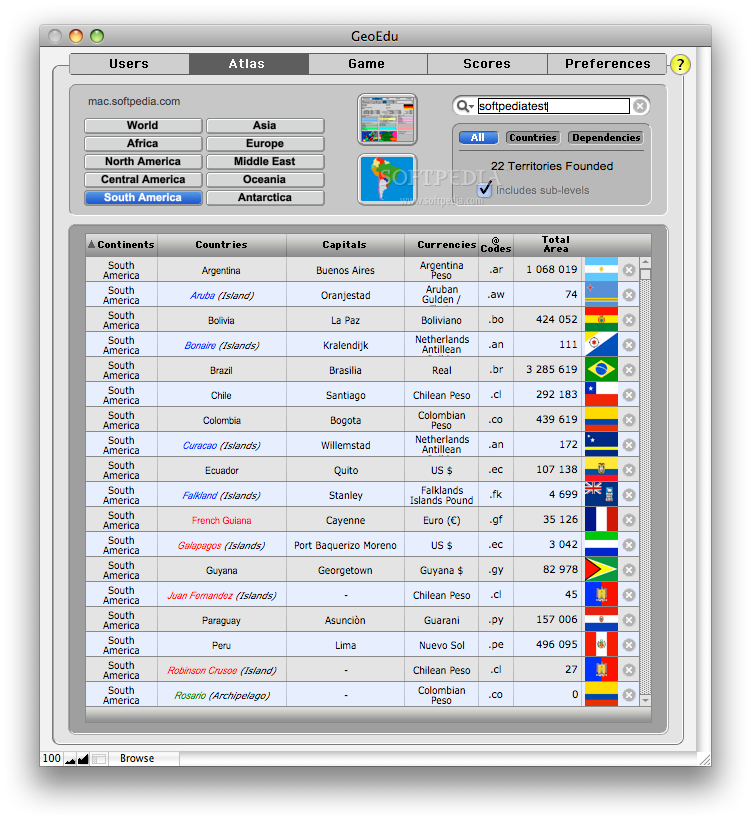
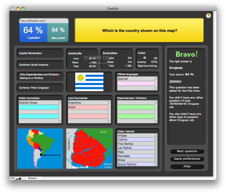
The Statistic view provides more detailed information, like the Capital name, currency, area code, total area and an image with the flag. If you press on the name of the country, the data gets even more specific. In order to provide easy browsing, a panel is added on the right side of the window with a list of the countries in the same region.
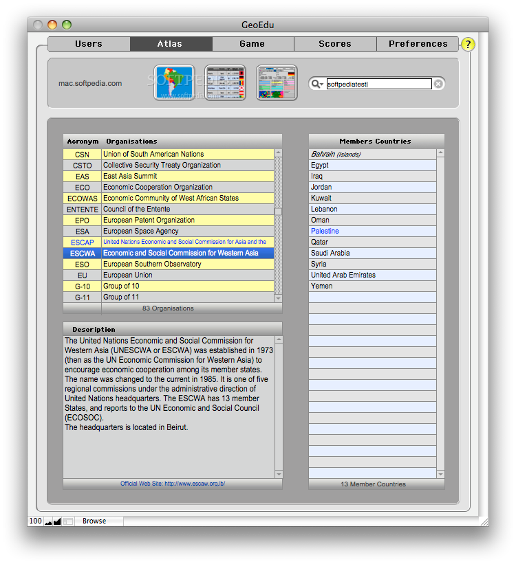
This part of the Atlas offers information about the official language, major cities, land borders, water borders but also about the organizations the state is a member of. If you press on the name of the organization, you will be able to see a brief description of its history and purpose. Of course, at all times the built in search engine is present in the top right corner in case you know exactly what you are looking for.
The Works
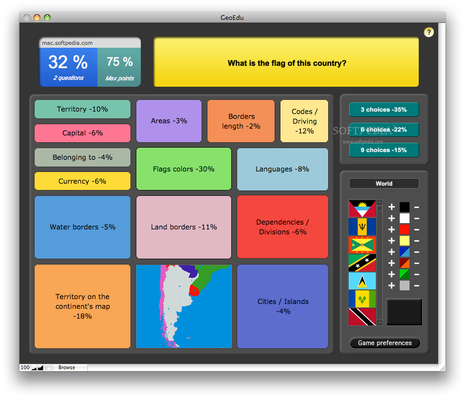
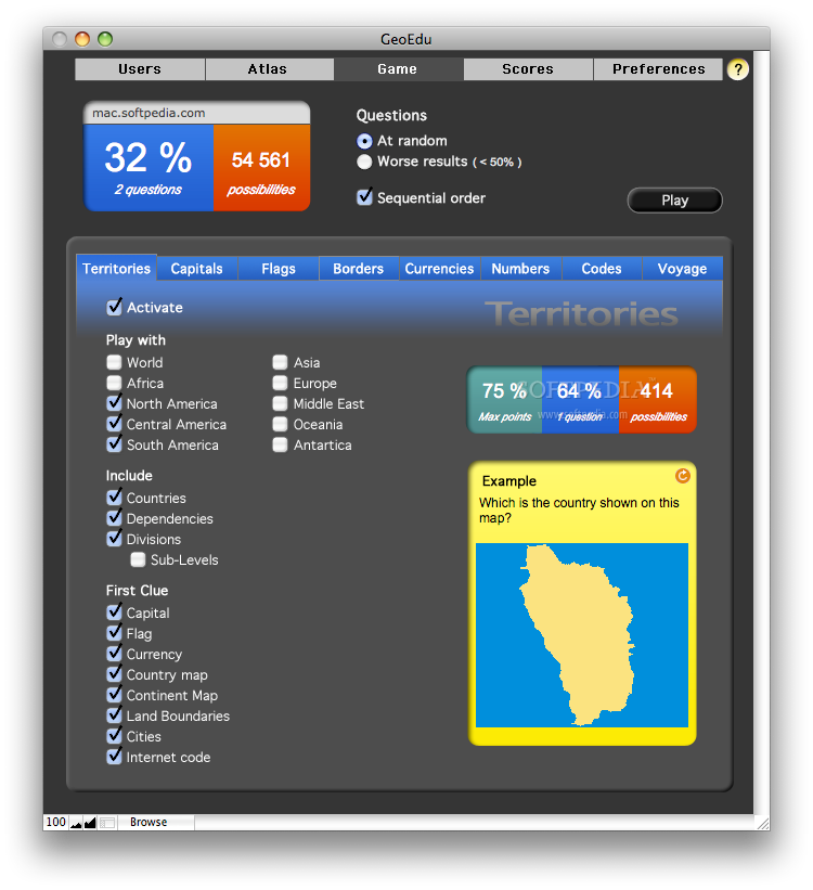
Once you have finished browsing the Atlas, it is time to test your knowledge. That is where the Game area comes in handy. The initial game panel has two distinct areas. On the top, you can see your percentage and you can choose the game mode: at random, with worst results or sequential order (taking questions from each category, going from the left side to the right). The percentage is your score and represents the number of correct answers proportionally with the number of questions asked. Below the percentage, you can see the number of questions asked and in the right, the number of possible questions.
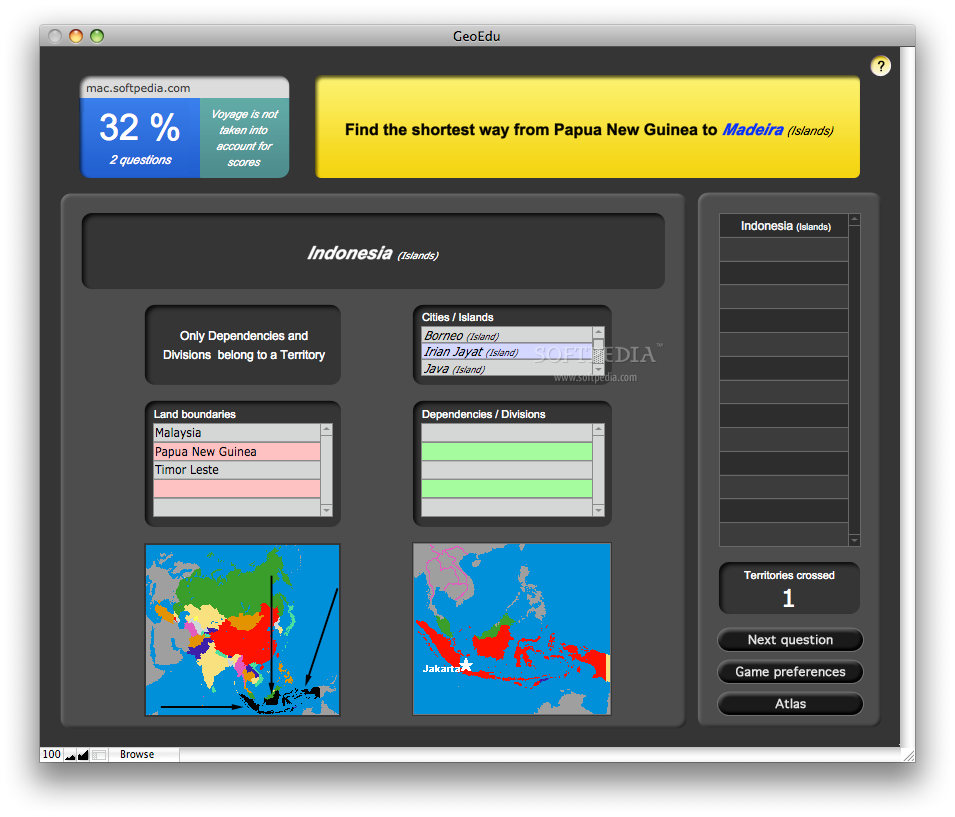
On the bottom, you can see the categories and you must activate at least one parameter in order to play. The choices are: Territories, Capitals, Flags, Borders, Currencies, Numbers, Codes and Voyage. The names of the categories are mostly self explanatory but the last one, Voyage, only gives you the possibility to find the shortest way from a territory to another without actually keeping score. The goal of the options provided by each panel is to adjust the level of knowledge, hence the difficulty level, so browse a little to see which ones suit your needs.
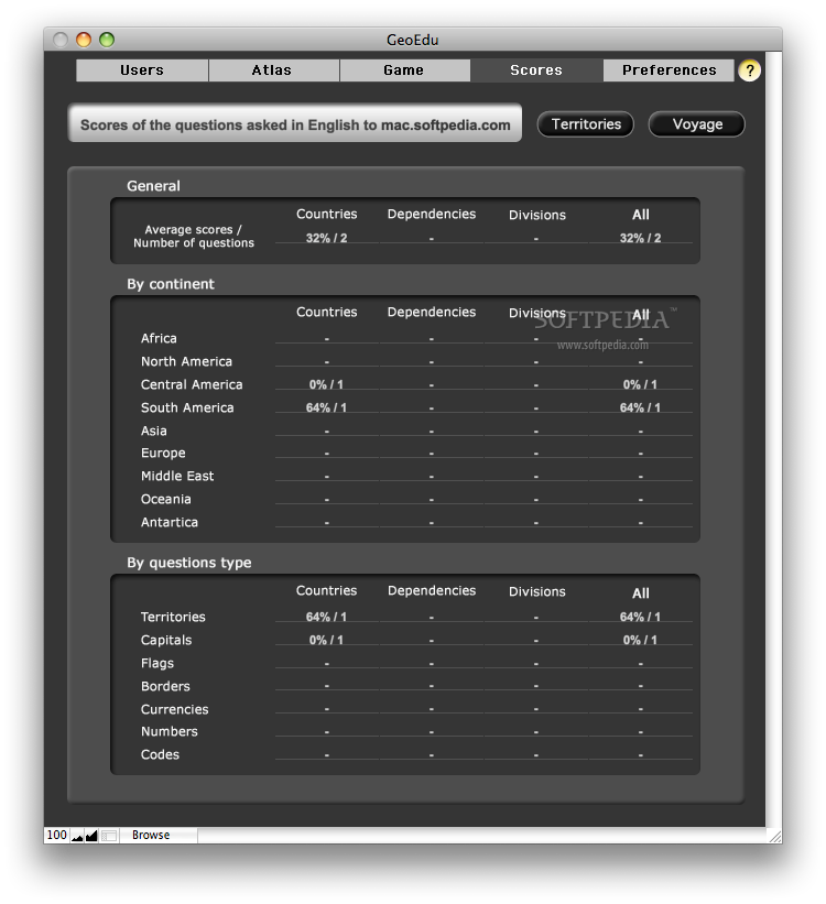
In order to see how proficient you have become, the Scores panel offers detailed info about your answers, grouping them by continent, question type, country, dependences and divisions. Still, the score is calculated for each user separately, so you can always compete with your friends.
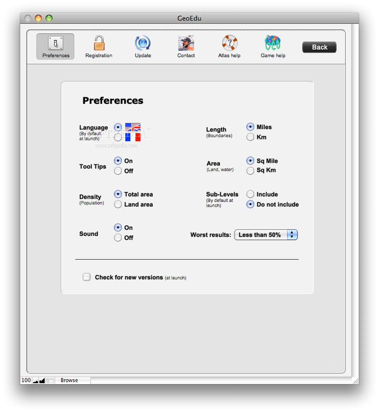
Since GeoEdu is a game dealing with geographical facts, the developers are aware that users might be used with different measurement systems. That is why the Preferences tab allows you to change the default length and area measurement units, but you may also change the interface language: English or French. The same area allows you to enable or disable the tool tips, choose to calculate the population density considering the land area or the total area, include the sub-levels, disable the sound and set the worst result limit.
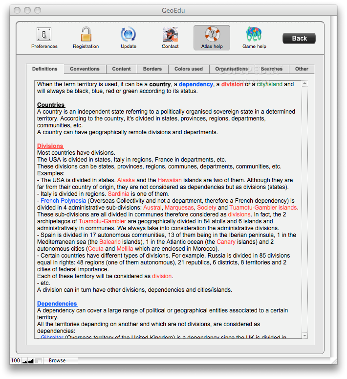
The concepts and the terms used by GeoEdu can be a bit confusing, so, if you need clarifications, the Preferences tab provides two very useful tutorials, one for the Atlas and one for the Game. If you are just having fun, you probably won’t be very interested in the Game help but, if you are “playing to win,” you should give it a quick read. On the other hand, the Atlas help provides insightful information, offering explanations for the geographical terms used throughout the application, that you will definitely find useful.
The Good
The Bad
The Truth
Here are some snapshots of the application in action: