14 DAY TRIAL //
 As we all know, the entire planet is divided in six large tectonic plates that are in constant movement. As a result, earthquakes may occur along the boundaries of a tectonic plate. Given the destructive force of a major earthquake, we are all interested in knowing the intensity, place and time of the event.
Even though you can track them by watching the news, Ron MacGillivray has created a program that shows you the recent worldwide seismic activity. It is called Quakeshakes. It is a free and simple Adobe AIR plug-in that works on multiple platforms such as Mac OS X or Windows. Don't worry about the hard-drive space because the plug-in "eats" somewhere around 6.9 Mb.
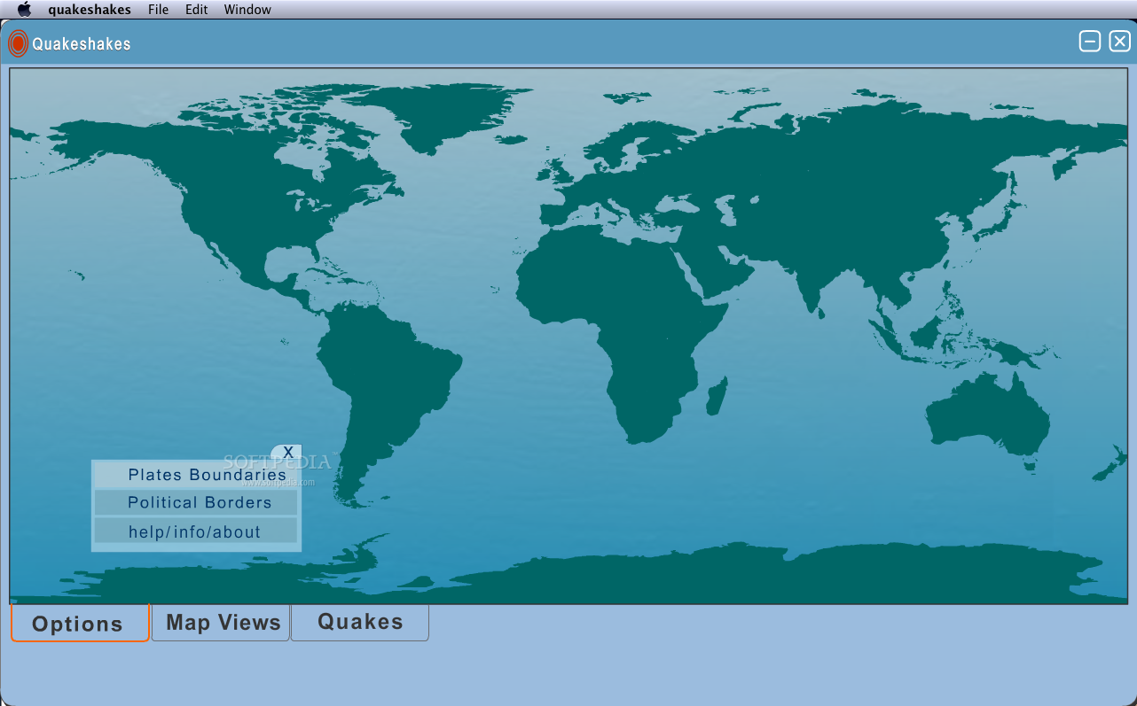
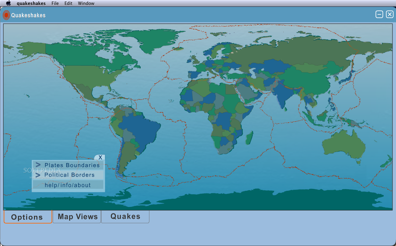
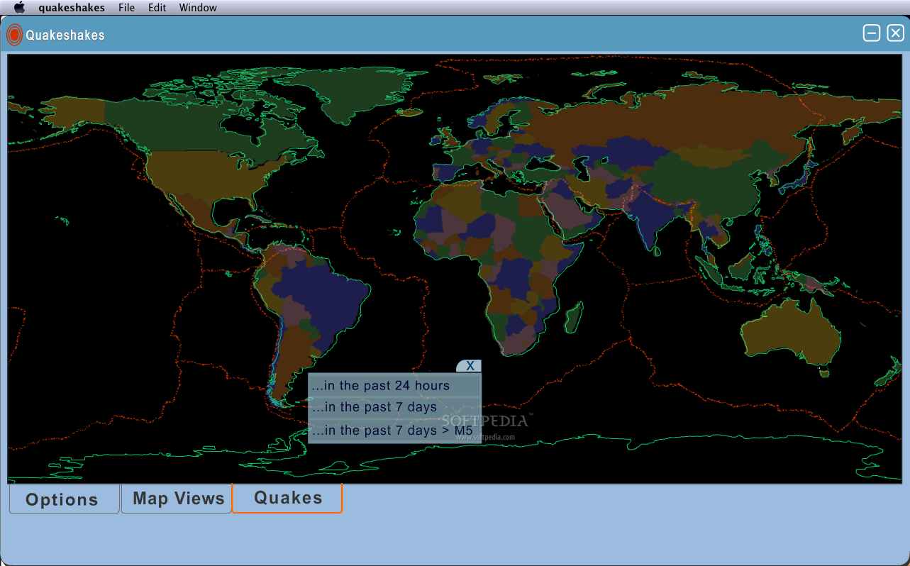
So, before you can start the program, you will have to install on your computer the Adobe AIR program because without it, Quakeshakes won't work. After you have installed the program, go to the Applications and click on the nice small icon representing a shockwave. Even though the size of the program is just 6.9 Mb, its interface is simple but very attractive and well proportioned. Most of the interface is occupied by a large world map. On the bottom left corner of the map, there are three rectangular buttons. The first one is the Options button that gives general information about this program or how you can contact the producer. For that, click on the Help/Info/About line. Click on the Plates Boundaries and the entire planet displayed on the map will be divided among all the (known) tectonic plates. This way, you can see the size of every plate and under which continent, country or ocean it is placed.
The Political Borders option makes the entire map display the borders of every country on the planet. As you can see, these two options can be activated at the same time, but if you want to deactivate only one, just click it one more time. Even if we are talking about tectonic plates or political borders, these two options can be used in educational purposes, in classroom labs or individual learning for those interested in Geography.
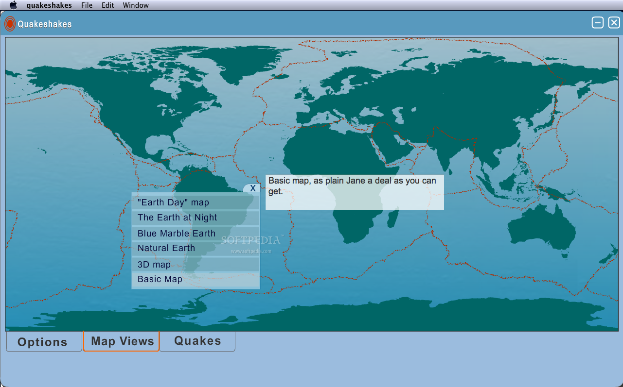
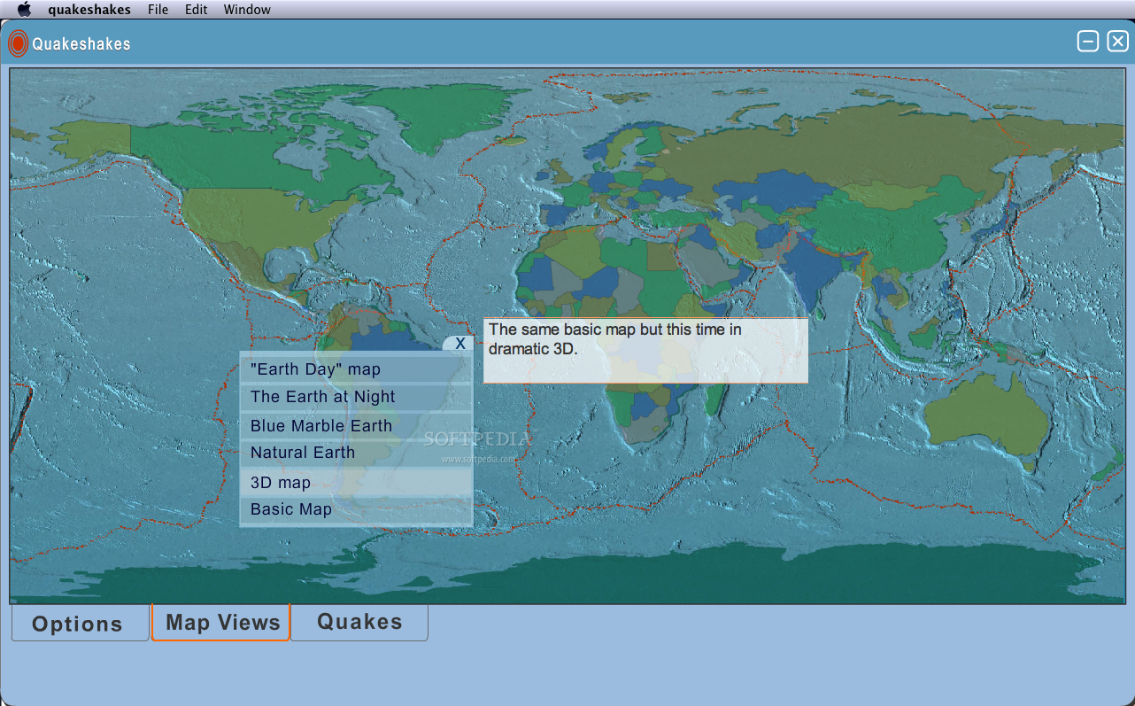
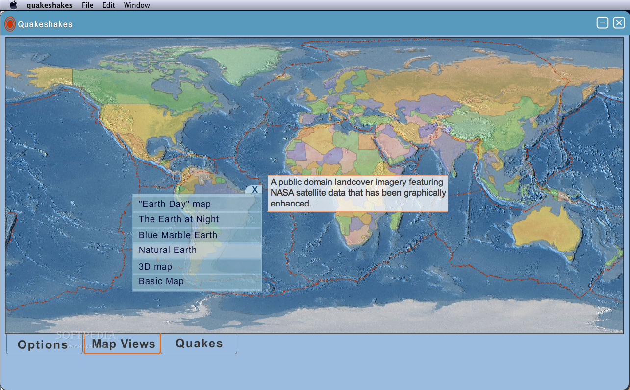
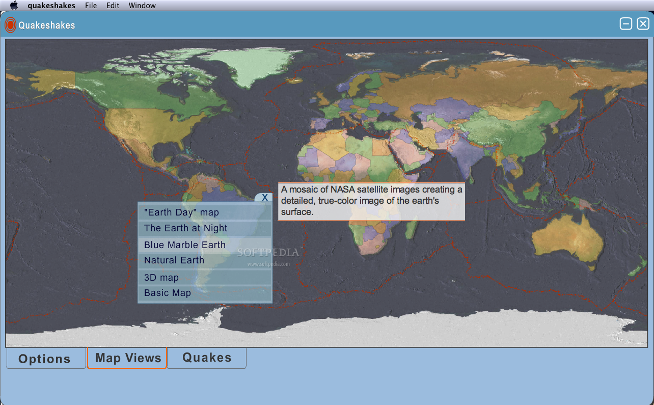
The second button, Map Views, customizes the way you view the map. In order to display an ordinary and plain map, just click on the Basic Map. Here, every detail offered is at its simplest. Clicking on the 3D map will change the interface with a 3D look that makes all mountains in the world more visible. The Natural and Blue Marbel map views enhance the images taken from NASA satellites. We can all see now, how the Earth looks from outer space.
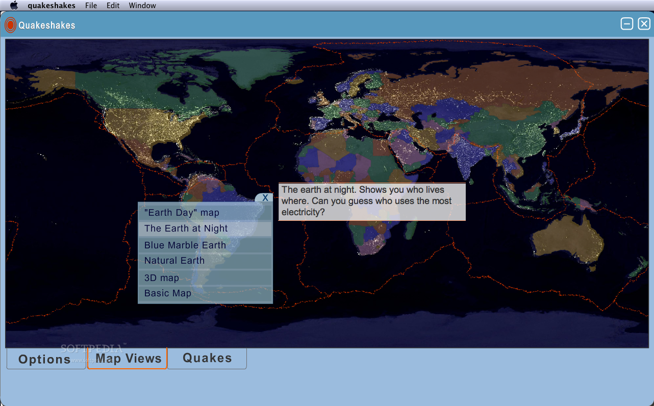
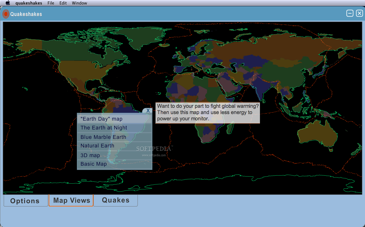
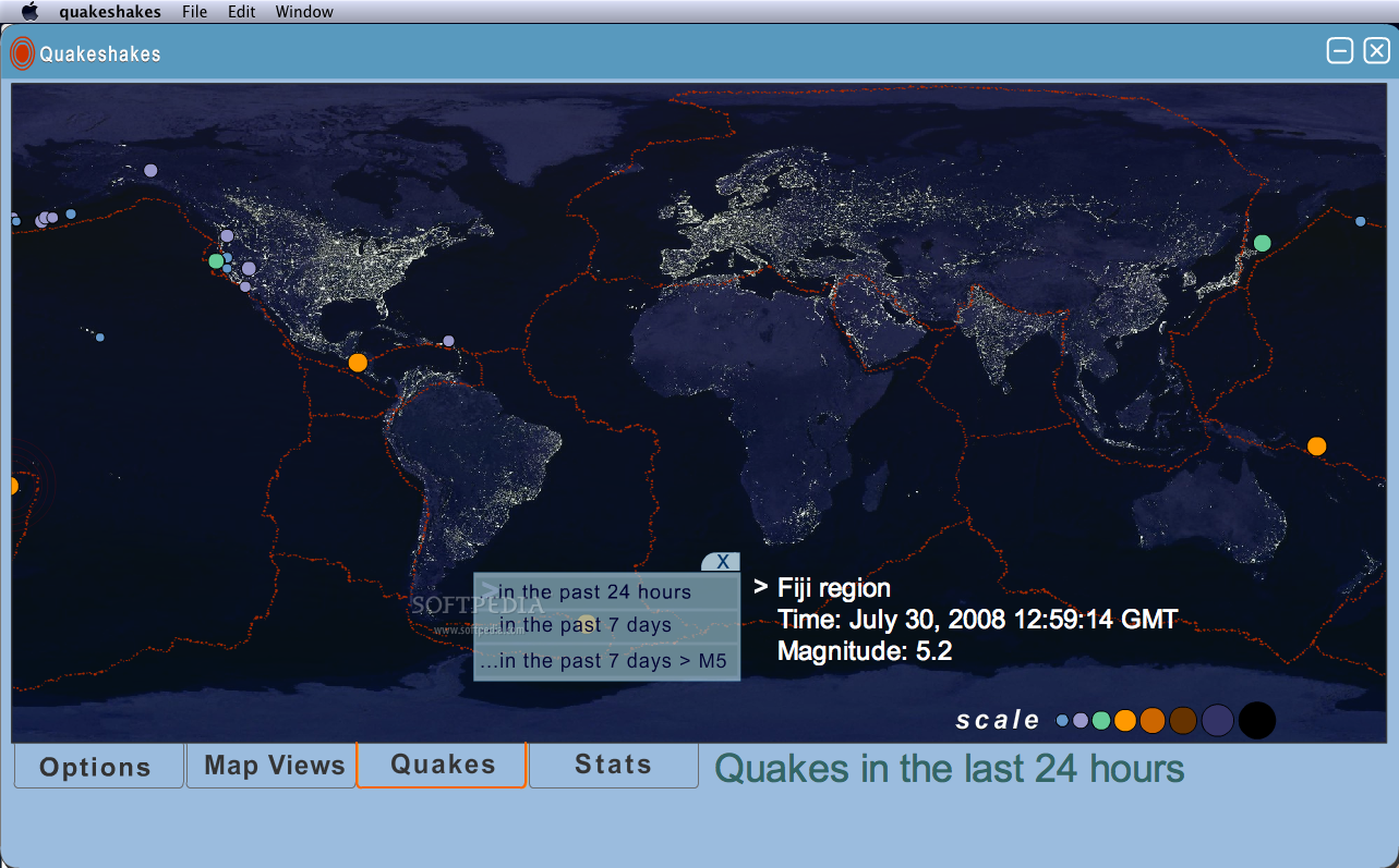
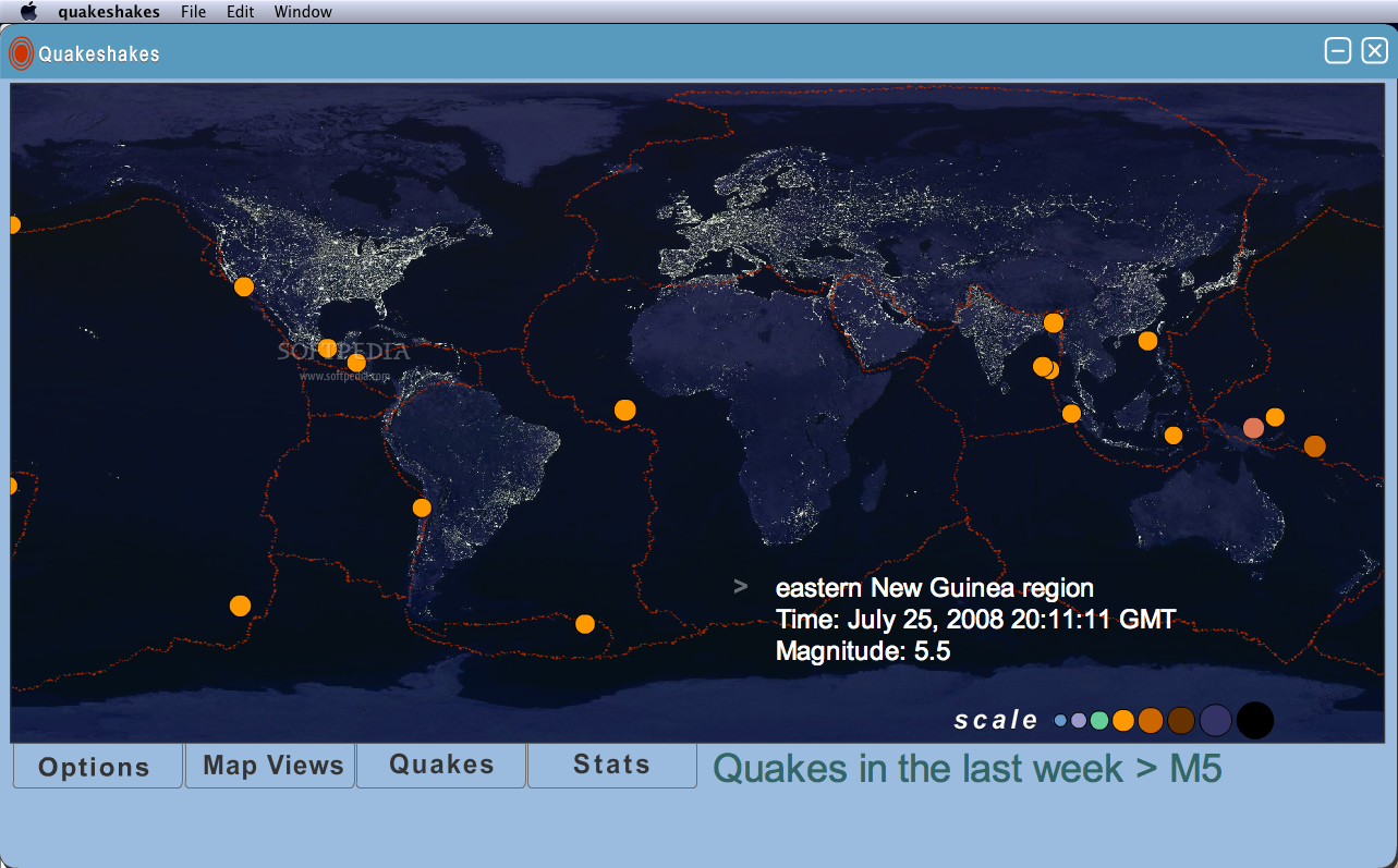
An interesting view of the planet can be accessed if you click on the Earth at Night. It shows where electricity is used on the planet and who uses it on a large scale. This way, it is very easy to see that there are a lot of places (besides deserts) occupied by humans that lack the basic need of electric power and that there are many cities or countries that consume a large amount of electricity especially on the western coast of the United States or in western Europe. You can be a small part of the solution for this problem if, during the day, you use the Earth Day map that reduces energy consumption (required to power your monitor).
The third rectangular button is the Quakes. It displays all the earthquakes from the last 24 hours or from the last seven days with the help of colored dots. If you place your pointer over one of them, Quakeshakes gives you additional information about the region, hour and scale of the earthquake.
This extension is permanently connected through Live Feed with USGS website that is connected as well to an entire network of seismic sensors updating every 30 minutes. Due to this 30-minute break, you have the chance to know about a recent earthquake even though it is not in the news yet.
The Good
Even though the purpose of Quakeshakes is to let you know the location, the time and the intensity of an earthquake, it can easily be used as educational software especially for Geography courses. It offers a unique way to view the entire planet and tries to warn us about the environmental problems that we are facing.
The Bad
During the testing period, Quakeshakes worked perfectly, without any kind of error. Although there are no complaints about how it works, the general impression is that more improvements can be made on the educational side. The Political map view can be enhanced with names for every country and links towards websites that may offer general information allowing us to enrich our knowledge about the planet.
The Truth
In case you are interested in earthquakes, Quakeshakes keeps you informed 24/7. In maximum 30 minutes, the latest events will be displayed on the map. From now on, every earthquake will be known by those that use this plug-in.
Here are some snapshots of the application in action: