A program to manage waypoints #Waypoint Manager #Waypoint Management #Manage Waypoint #Waypoint #Mapper #Location
The WaypointTool application was designed to be a program to manage waypoints. It can be used to calculate coordinates between RD (Dutch Grid) and to view waypoint locations in Google Maps. Perhaps you can find more purposes for it.
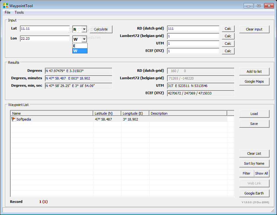
Enter coordinates: Either in WGS84 format or RD format. You can use any format of degrees, minutes and seconds you like. You can also enter a string in the geocaching format (for example “N 51° 32.841 E 004° 16.389”) in the first field. The program defaults to North and East.
Waypoint list: The following file formats are supported: - GPX The standard file format for geocaching. - LOC An alternative file format for geocaching. - OV2 Used by TomTom. Only name and coordinates are saved in this format. - TXT A home-brew format in plain text consisting of “latitude longitude ; name”
System requirements
What's new in WaypointTool 1.8.0.0:
- Bugfix:
- The option to launch the real cache website for waypoints, didn't work correctly.
- The 'Clear input' button didn't clear the ECEF field.
- New:
WaypointTool 1.8.0.0
add to watchlist add to download basket send us an update REPORT- runs on:
- Windows All
- file size:
- 2.2 MB
- filename:
- WaypointToolSetup.zip
- main category:
- Internet
- developer:
- visit homepage
Zoom Client

Windows Sandbox Launcher

Bitdefender Antivirus Free

calibre

Microsoft Teams

IrfanView

Context Menu Manager

ShareX

7-Zip

4k Video Downloader

- ShareX
- 7-Zip
- 4k Video Downloader
- Zoom Client
- Windows Sandbox Launcher
- Bitdefender Antivirus Free
- calibre
- Microsoft Teams
- IrfanView
- Context Menu Manager