CAD drawing application for architectural surveys, photogrammetry and mapping, featuring multiple transformation options and enhanced support for project exports. #Surface editor #Correct deformation #Photo digitization #Photogrammetry #Digitization #Deformation
DigiCad 3D is an advanced CAD drawing application made for architectural surveys, photogrammetry and mapping. It's capable of importing and exporting projects to images as well as DWG, DXF, XYZ and CXF file types.
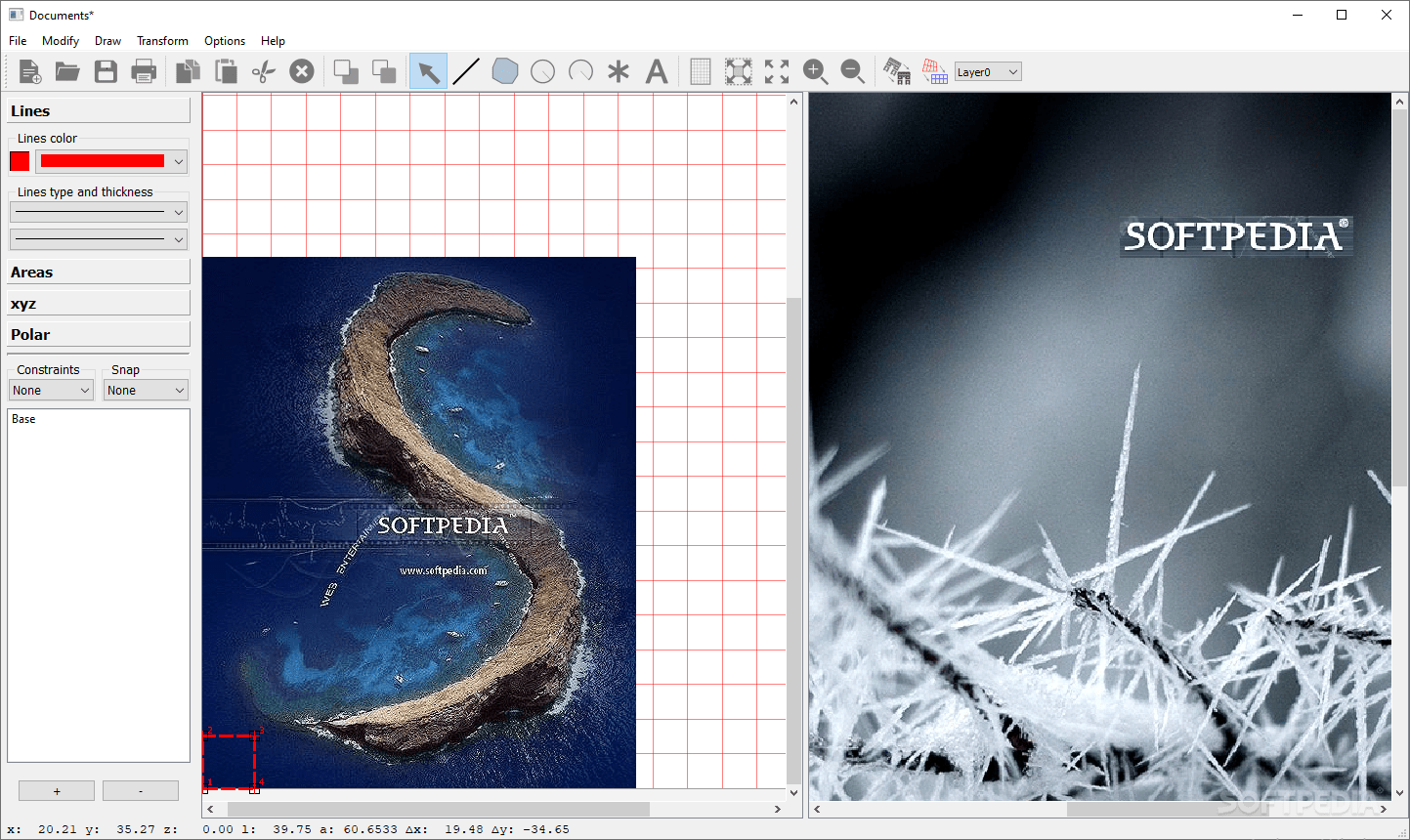
Wrapped up in a seemingly outdated, yet user-friendly interface, the program puts several drawing tools at your disposal, such as arrow, tablet, segment, polygons, circles, arches, text, marker, and calculator.
As far as customization is concerned, you can select the marker type, line and fill patterns, color, and thickness. It's also possible to enter the Z coordinate value and polygon hatching parameters, configure font settings, insert vertices and markers, change the viewing mode (e.g. sheet view, zoom), and set constraints, such as snap to points, Z coordinate or grid.
Objects can be converted to polygons or segments, and re-arranged by sending them to the back or bringing them to the front. You can change the layer, scale the selected image, or obtain an image from the selection with the preferred resolution.
When it comes to object transformation, DigiCad 3D lets you insert origin and destination attachment points, turn a selection of points into the origin or destination, specify the coordinates of the origin and destination points, add a selection to the destination, create the origin or destination mesh, transform a selected image using a point or mesh, rotate or modify an image, as well as apply optical correction.
Projects can be saved as DigiCad 3D project files (DGC format) and later resumed. As previously mentioned, they can be exported to image files (EMF or BMP), DWG or DXF (supported by AutoCAD and others), or XYZ. In case of XYZ, you can indicate the field contents and design format.
We haven't come across any stability issues in our tests, thanks to the fact that the application didn't hang, crash or prompt error messages. Surprisingly, it left a small footprint on system resources, so it didn't hamper the PC's performance.
Its interface could use a facelift. Otherwise, DigiCad 3D comes loaded with advanced and approachable options to help you work with architectural surveys, photogrammetry and mapping projects.
What's new in DigiCad 3D 10.0.5:
- Measures and distances on polygons and lines.. Selecting a polygon or a line displays a series of information: distances for each side of the polygon and on the line, perimeter, area and length for the polygons:
- Measurements are displayed simultaneously on elements in the origin window and in the destination window.
- The destination window displays any measures that have been transformed according to the set attachment points.
- Tool Tips. Many Tool Tips have been included to help both the interface elements and the drawings. The Tool Tip appears by remaining stationary for a few seconds above the relevant element. In the case of graphic elements, the Tool Tip identifies the element in the foreground. For example, if I have an image with a polygon on it, the Tool Tip will display “Polygon”.
DigiCad 3D 10.0.5
add to watchlist add to download basket send us an update REPORT- runs on:
-
Windows 10 32/64 bit
Windows 8 32/64 bit
Windows 7 32/64 bit
Windows Vista 32/64 bit
Windows XP 32/64 bit - file size:
- 741 MB
- filename:
- Install_DigiCad3D1005.exe
- main category:
- Science / CAD
- developer:
- visit homepage
4k Video Downloader

7-Zip

ShareX

IrfanView

Zoom Client

Context Menu Manager

Windows Sandbox Launcher

Bitdefender Antivirus Free

Microsoft Teams

calibre

- Bitdefender Antivirus Free
- Microsoft Teams
- calibre
- 4k Video Downloader
- 7-Zip
- ShareX
- IrfanView
- Zoom Client
- Context Menu Manager
- Windows Sandbox Launcher