Comprehensive software designed to help you perform one-dimensional hydraulic calculations for natural or constructed channels with the aid of graphs and reports, data storage and management options, RAS Mapper, as well as hydraulic analysis. #River analysis system #Hydrologic engineering #Compute steady flow #CAD #Hydrology #Analysis
HEC-RAS is a professional Windows application whose purpose is to help engineers perform detailed water flow and sedimentary computations.
It offers support for multiple analysis parameters, namely steady flow water surface profile computations, unsteady flow simulation, movable boundary sediment transport computations, and water quality.
Hydraulic engineers may take advantage of channel flow analysis and floodplain determination. This one-dimension utility is able to model water flowing through systems of open channels and compute water surface profiles.
The tool comes packed with a bunch of dedicated parameters, so you need to take some time and experiment with the built-in features. There’s also support for a comprehensive help manual in case you want to find out more about the program’s capabilities, as well as tooltips.
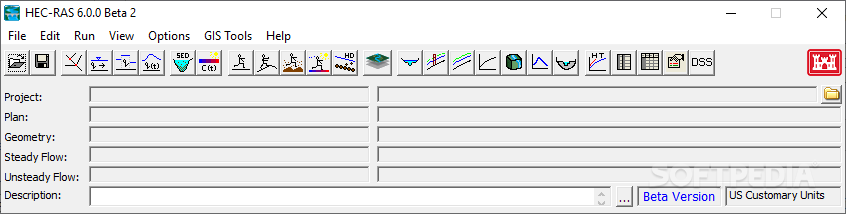
From the user interface you can activate the following functions: file management, data entry and editing operations, hydraulic analyses, tabulation and graphical displays of input and output data, and reports.
The program gives you the possibility to create multiple projects, store the input data in flow files under separate categories (project, plan, geometry, steady flow, unsteady flow, and sediment data), create graphs which embed X-Y plots of the river system schematic, cross-sections, profiles, rating curves, hydrographs, and many other hydraulic variables, as well as generate a three-dimension plot of multiple cross-sections. Graphs can be printed or copied to the clipboard.
The RAS Mapper gives you the possibility to perform inundation mapping of water surface profile results directly from HEC-RAS. The utility is able to generate inundation depth and floodplain boundary datasets based on the HEC-RAS geometry and computed water surface profiles. The depth grip can be exported to FLT file format while dataset can be saved to ESRI's shapefile format.
HEC-RAS comes packed with a decent suite of features for helping you perform one-dimensional hydraulic calculations for natural or constructed channels. It provides support for graphs and reports, data storage and management options, RAS Mapper, as well as hydraulic analysis.
What's new in HEC-RAS 6.5 Beta:
- Major issues:
- Sediment Rating Curve Calculator Does not Update Annual Load
- Sediment Rating Curve Calculator is Unit Naïve
- Floodway Encroachments - Blocked Culverts
HEC-RAS 6.4.1 / 6.5 Beta
add to watchlist add to download basket send us an update REPORT- PRICE: Free
- runs on:
-
Windows 11
Windows 10 64 bit - file size:
- 202 MB
- filename:
- HEC-RAS_641_Setup.exe
- main category:
- Science / CAD
- developer:
- visit homepage
IrfanView

7-Zip

Windows Sandbox Launcher

Microsoft Teams

calibre

ShareX

Context Menu Manager

4k Video Downloader

Bitdefender Antivirus Free

Zoom Client

- 4k Video Downloader
- Bitdefender Antivirus Free
- Zoom Client
- IrfanView
- 7-Zip
- Windows Sandbox Launcher
- Microsoft Teams
- calibre
- ShareX
- Context Menu Manager